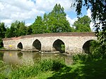
Greensand Ridge

The Greensand Ridge, also known as the Wealden Greensand is an extensive, prominent, often wooded, mixed greensand/sandstone escarpment in south-east England. Forming part of the Weald, a former dense forest in Sussex, Surrey and Kent, it runs to and from the East Sussex coast, wrapping around the High Weald and Low Weald. It reaches its highest elevation, 294 metres (965 ft), at Leith Hill in Surrey—the second highest point in south-east England, while another hill in its range, Blackdown, is the highest point in Sussex at 280 metres (919 ft). The eastern end of the ridge forms the northern boundary of Romney Marsh. About 51 per cent of the Wealden Greensand is protected as the South Downs National Park, Kent Downs Area of Outstanding Natural Beauty and Surrey Hills Area of Outstanding Natural Beauty.
Excerpt from the Wikipedia article Greensand Ridge (License: CC BY-SA 3.0, Authors, Images).Greensand Ridge
Leith Hill Lane, Mole Valley
Geographical coordinates (GPS) Address Nearby Places Show on map
Geographical coordinates (GPS)
| Latitude | Longitude |
|---|---|
| N 51.166666666667 ° | E -0.36666666666667 ° |
Address
Leith Hill Lane
RH5 6LY Mole Valley
England, United Kingdom
Open on Google Maps


