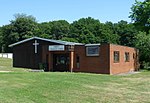
South Holmwood
Mole ValleyUse British English from July 2016Villages in Surrey

South Holmwood () is a semi-rural village in Surrey, England. It can be considered cognate with its wider civil parish, which stretches to the east to embrace Holmwood Common, but does not include Mid Holmwood, or North Holmwood, the latter being contiguous with Dorking. Betchett's Brook is the southern boundary and runs through a locality known as Holmwood Corner. However, Holmwood railway station is within the parish of Capel, although connected to the South Holmwood by a curved path passing through Holmwood Corner Common. Centred 3 miles (4.8 km) south of Dorking, South Holmwood is on the A24 London to Worthing road, a dual carriageway through the village.
Excerpt from the Wikipedia article South Holmwood (License: CC BY-SA 3.0, Authors, Images).South Holmwood
Norfolk Lane, Mole Valley
Geographical coordinates (GPS) Address Website Nearby Places Show on map
Geographical coordinates (GPS)
| Latitude | Longitude |
|---|---|
| N 51.202 ° | E -0.323 ° |
Address
Holmwood Common
Norfolk Lane
RH5 4EU Mole Valley
England, United Kingdom
Open on Google Maps


