A24 road (England)
Geographic coordinate listsInfobox road instances in EnglandLists of coordinatesRoads in LondonRoads in Surrey ... and 6 more
Roads in West SussexStreets in the London Borough of LambethStreets in the London Borough of WandsworthTransport in the London Borough of MertonTransport in the London Borough of SuttonUse British English from January 2014

The A24 is a major road in England that runs for 53.2 miles (85.6 km) from Clapham in south-west London to Worthing on the English Channel in West Sussex via the suburbs of south-west London, as well as through the counties of Surrey and West Sussex.
Excerpt from the Wikipedia article A24 road (England) (License: CC BY-SA 3.0, Authors, Images).A24 road (England)
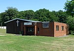
Horsham Road, Mole Valley Holmwood
Geographical coordinates (GPS) Address Nearby Places Show on map
Geographical coordinates (GPS)
| Latitude | Longitude |
|---|---|
| N 51.2065 ° | E -0.331 ° |
Address
Horsham Road
Horsham Road
RH5 4EN Mole Valley, Holmwood
England, United Kingdom
Open on Google Maps


