Huntingdale, Victoria

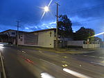
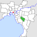
Huntingdale is a suburb in Melbourne, Victoria, Australia, 16 km south-east of Melbourne's Central Business District, located within the City of Monash local government area. Huntingdale recorded a population of 1,949 at the 2021 census.The suburb is bordered by Huntingdale Road to the east, North Road to the south, Franklyn Street to the west and the Princes Highway to the north. The suburbs of Oakleigh, Huntingdale, and Oakleigh East all share the same postcode of 3166. The suburb has both residential and industrial areas, with the southern sections between Hargeaves Street and North Road being largely industrial. The suburb has a noticeable Muslim and Hindu presence, with a mosque and a Hindu temple, as well as being home to the Australian Islamic Bangladesh Council.
Excerpt from the Wikipedia article Huntingdale, Victoria (License: CC BY-SA 3.0, Authors, Images).Huntingdale, Victoria
Andrew Street, Melbourne Oakleigh
Geographical coordinates (GPS) Address Nearby Places Show on map
Geographical coordinates (GPS)
| Latitude | Longitude |
|---|---|
| N -37.907 ° | E 145.094 ° |
Address
Andrew Street 23
3617 Melbourne, Oakleigh
Victoria, Australia
Open on Google Maps


