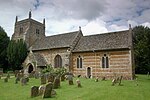
A4260 road
England road stubsGeographic coordinate listsInfobox road instances in EnglandInfobox road maps tracking categoryLists of coordinates ... and 3 more
Roads in EnglandRoads in OxfordshireUse British English from February 2013

The A4260 is a road that leads from the A422 Henneff Way, Banbury to Frieze Way near Oxford.
Excerpt from the Wikipedia article A4260 road (License: CC BY-SA 3.0, Authors, Images).A4260 road
Oxford Road, Cherwell District North Aston
Geographical coordinates (GPS) Address Nearby Places Show on map
Geographical coordinates (GPS)
| Latitude | Longitude |
|---|---|
| N 51.9523 ° | E -1.3186 ° |
Address
Oxford Road
Oxford Road
OX25 6JE Cherwell District, North Aston
England, United Kingdom
Open on Google Maps


