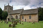
Horsehay Quarries
Geological Conservation Review sitesSites of Special Scientific Interest in Oxfordshire

Horsehay Quarries is a 8.4-hectare (21-acre) geological Site of Special Scientific Interest west of Bicester in Oxfordshire. It is a Geological Conservation Review site.These quarries expose rocks dating to the Middle Jurassic period. The sequence runs from the Northampton Sand Formation of the Aalenian about 172 million years ago to the Taynton Limestone Formation of the Middle Bathonian around 167 million years ago.The site is private land with no public access.
Excerpt from the Wikipedia article Horsehay Quarries (License: CC BY-SA 3.0, Authors, Images).Horsehay Quarries
Duns Tew Road, Cherwell District Duns Tew
Geographical coordinates (GPS) Address Nearby Places Show on map
Geographical coordinates (GPS)
| Latitude | Longitude |
|---|---|
| N 51.941 ° | E -1.338 ° |
Address
Duns Tew Road
Duns Tew Road
OX7 7DE Cherwell District, Duns Tew
England, United Kingdom
Open on Google Maps


