North Aston

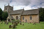
North Aston is a village and civil parish about 7+1⁄2 miles (12 km) south of Banbury and 10 miles (16 km) north of Oxford. The 2001 Census recorded its population as 212. The 2011 Census did not publish its population separately, but gave a combined total of 316 for the parishes of North Aston and Middle Aston. The village is on a ridge about 460 feet (140 m) above sea level. The parish measures almost 2 miles (3 km) wide east – west and about 1+1⁄2 miles (2.4 km) north – south. It is bounded to the east by the River Cherwell, and to the north by a stream that flows east to join the Cherwell. The A4260 road linking Oxford and Banbury forms part of its western boundary. Field boundaries form the southern boundary and the remainder of the western boundary. In 1983 the parish covered an area of 1,288 acres (521 ha).
Excerpt from the Wikipedia article North Aston (License: CC BY-SA 3.0, Authors, Images).North Aston
The Green, Cherwell District North Aston
Geographical coordinates (GPS) Address Nearby Places Show on map
Geographical coordinates (GPS)
| Latitude | Longitude |
|---|---|
| N 51.956 ° | E -1.309 ° |
Address
The Green
The Green
OX25 6HU Cherwell District, North Aston
England, United Kingdom
Open on Google Maps


