Kirklington, Nottinghamshire

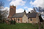
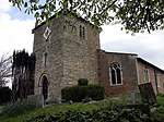
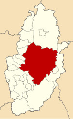
Kirklington is a village and civil parish in the Newark and Sherwood district of Nottinghamshire, England. The population as of the 2011 census was 400, falling to 388 at the 2021 census. Kirklington lies on the A617 road between Newark (9½ miles to the east) and Mansfield (10 miles to the west). Kirklington once had a railway station on the Mansfield-Southwell line; it was closed to passenger traffic in 1929 and goods trains in 1964. The former trackbed is now the Southwell Trail footpath. The place-name Kirklington seems to contain an Old English personal name, Cyrtla, + tun (Old English), an enclosure; a farmstead; a village; an estate.., so 'Cyrtla's farm or settlement'. It might instead stem from Kirk-, an element found in a number of place names in the United Kingdom, deriving from kirk (Scottish), a general assembly; a church. This may refer to St. Swithun's Church, the parish church located in Kirklington.
Excerpt from the Wikipedia article Kirklington, Nottinghamshire (License: CC BY-SA 3.0, Authors, Images).Kirklington, Nottinghamshire
Church Lane, Newark and Sherwood
Geographical coordinates (GPS) Address Nearby Places Show on map
Geographical coordinates (GPS)
| Latitude | Longitude |
|---|---|
| N 53.11126 ° | E -0.9856 ° |
Address
Church Lane
Church Lane
NG22 8NA Newark and Sherwood
England, United Kingdom
Open on Google Maps


