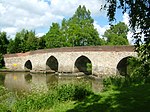
Ockley
Civil parishes in SurreyMole ValleyVillages in Surrey

Ockley is a rural village in Surrey. It lies astride the A29, the modern road using the alignment of Stane Street (Chichester). The A29 diverges from the A24 from London about 2.5 miles northeast and takes the alignment of Stane Street a mile north of the village. It has a medieval parish church, see list of places of worship in Mole Valley.
Excerpt from the Wikipedia article Ockley (License: CC BY-SA 3.0, Authors, Images).Ockley
Stane Street, Mole Valley Ockley
Geographical coordinates (GPS) Address Nearby Places Show on map
Geographical coordinates (GPS)
| Latitude | Longitude |
|---|---|
| N 51.148 ° | E -0.363 ° |
Address
Stane Street
RH5 5TD Mole Valley, Ockley
England, United Kingdom
Open on Google Maps


