Cushetunk Mountain
Igneous intrusionsIgneous petrology of New JerseyJurassic magmatismLandforms of Hunterdon County, New JerseyMountains of New Jersey ... and 3 more
Readington Township, New JerseyTriassic magmatismVolcanoes of the United States

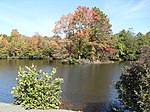
Cushetunk Mountain (formerly Mount Ployden and Pickel's Mountain occasionally Mount Cushetunk or Coshanton) is a ring shaped mountain in the U.S. state of New Jersey, located in Readington and Clinton Township in Hunterdon County. The Lenape Native Americans called the mountain "Cushetunk" meaning "place of hogs" after the wild hogs found there. In the 1960s, the valley at the heart of the mountain was dammed and filled with water to create Round Valley Reservoir. Today, the mountain and its accompanying lake act as a vital water supply to Central New Jersey, while at the same time providing numerous recreational opportunities to the region.
Excerpt from the Wikipedia article Cushetunk Mountain (License: CC BY-SA 3.0, Authors, Images).Cushetunk Mountain
Red Cushetunk Trail,
Geographical coordinates (GPS) Address Nearby Places Show on map
Geographical coordinates (GPS)
| Latitude | Longitude |
|---|---|
| N 40.598611111111 ° | E -74.824722222222 ° |
Address
Red Cushetunk Trail
Red Cushetunk Trail
08885
New Jersey, United States
Open on Google Maps


