place

Stanton, New Jersey

Historic districts on the National Register of Historic Places in New JerseyNRHP infobox with nocatNational Register of Historic Places in Hunterdon County, New JerseyUnincorporated communities in Hunterdon County, New JerseyUnincorporated communities in New Jersey
Unincorporated communities in Readington Township, New JerseyUse American English from July 2023Use mdy dates from July 2023
StantonMountainGeneralStore

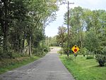
Stanton is an unincorporated community located within Readington Township in Hunterdon County, in the U.S. state of New Jersey. The community dates back to the 17th century and was settled by the Dutch immigrants. It was originally called Housel's after Johannes Housel, who had a farmstead along Dreahook Road in the mid-18th century. After the death of William Housel (who started a school in the community), the last owner of the Housel farmstead, it then carried the name of Waggoner's Hill after landowner William Waggoner. The community took the descriptive name of Mount Pleasant in the early 20th century and would finally become known as Stanton to distinguish it from another Mount Pleasant. The name "Stanton" was taken from James Logan's Pennsylvania estate: Stenton, which in turn is named for the Scottish village where his father was born. Logan was a proprietor of West Jersey, a mayor of Philadelphia, and a Chief Justice of the Supreme Court of Pennsylvania. Logan Way in Readington is named after him, as well as Logan Circle and the Logan neighborhood in Philadelphia and Logan Township in Clinton County, Pennsylvania. In the 1830s, a Reformed Church and a general store were built. The Stanton Reformed Church still stands today while the Stanton General Store has been converted to an Italian restaurant called the Stanton Italian Table.

Excerpt from the Wikipedia article Stanton, New Jersey (License: CC BY-SA 3.0, Authors, Images).

Stanton, New Jersey
Buell Trail (Orange),

Geographical coordinates (GPS) Address Nearby Places
placeShow on map

Wikipedia: Stanton, New JerseyContinue reading on Wikipedia

Geographical coordinates (GPS)

Latitude Longitude
N 40.575 ° E -74.837777777778 °
placeShow on map

Address

Readington Township Open Space

Buell Trail (Orange)
08885
New Jersey, United States
mapOpen on Google Maps

StantonMountainGeneralStore
Share experience

Nearby Places

Round Valley Reservoir

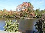
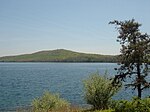
The Round Valley Reservoir in Clinton Township in Hunterdon County, New Jersey, United States, was formed in 1960 when the New Jersey Water Authority constructed two large dams and flooded a large valley. The reservoir is named after the naturally formed circular valley surrounded by Cushetunk Mountain. The deep valley was caused by erosion of the soft sedimentary rock. The surrounding ridges of Cushetunk Mountain endure because they were underlaid with dense and durable volcanic rock diabase that cooled slowly under the surface of the Earth. The reservoir covers what used to be a farming community, with remains of a school and a church on the lake floor among other buildings.Reaching depths of 180 feet (55 m), this 2,350 acres (9.5 km2) reservoir is best known for its pristine clear blue waters. The reservoir contains 55 billion US gallons (210,000,000 m3) of water for use in central New Jersey, making it the largest in the state. Its water is distributed during times of drought via the nearby south branch of the Raritan River. The New Jersey Division of Wildlife (a department of the New Jersey Department of Environmental Protection) claims the reservoir is the southernmost body of water that contains naturally reproducing lake trout. This is one of only two lakes in New Jersey with lake trout, the other being Merrill Creek Reservoir in Warren County. Some of the other species of fish in the lake include bass, pickerel, catfish, american eel, yellow perch, brown trout, and rainbow trout. The park also has a wilderness area for camping, swimming and SCUBA diving facilities, a boat ramp and nature hiking and biking trails. The reservoir has been called the Bermuda Triangle of New Jersey, and over 26 people have drowned there since 1971. Six of them have never been found.

Flemington Junction station

Flemington Junction station is a defunct Lehigh Valley Railroad station in Flemington Junction, New Jersey. It was located at the junction of the Lehigh Valley's Flemington Branch and Main Line, although the name predated the opening of the branch by eight years. The Lehigh Valley Railroad, via its Easton and Amboy Railroad subsidiary, extended its main line east from Easton, Pennsylvania, to Jersey City, New Jersey, between 1872 and 1875. The extension officially opened on June 28, 1875. The location, which had passenger service but no passenger building, was then called Barton's Bridge. A stagecoach line carried passengers into Flemington, New Jersey proper. The company adopted the name "Flemington Junction" on April 16, 1876. A freight house opened later that year. A separate passenger building was not constructed until 1879–1882. The Flemington Branch, a 1.7-mile (2.7 km) line into Flemington, opened on August 4, 1884.As late as 1948 a gas-electric motor car made eleven round-trips per day between Flemington Junction and Flemington, but change was coming. Buses replaced the train over the branch in 1952; the buses themselves were withdrawn in 1957. The freight house was torn down in 1955 as business declined. Passenger service to Flemington Junction ended on February 4, 1961, with the end of all passenger service on the Lehigh Valley. The Lehigh Valley abandoned the building in 1963.The station building still stands and is a contributing property of the Raritan–Readington South Branch Historic District. The current building will be demolished by the end of 2019.