Fort Dupont
Neighborhoods in Southeast (Washington, D.C.)Washington, D.C., geography stubs

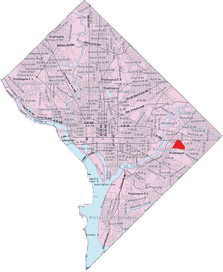
Fort Dupont is a residential neighborhood located in southeast Washington, D.C., east of the Anacostia River. It is bounded by East Capitol Street to the north, Fort Dupont Park to the south, Minnesota Avenue to the west, and Fort Chaplin Park to the east and northeast. Fort Dupont has a population of approximately 7,050.Fort Dupont is adjacent to Fort Dupont Park, the grounds of a Civil War-era fort that was constructed for the defense of Washington. Fort Dupont is a distinct neighborhood from the nearby Dupont Park, although both border the park and take their name from it.
Excerpt from the Wikipedia article Fort Dupont (License: CC BY-SA 3.0, Authors, Images).Fort Dupont
C Street Southeast, Washington
Geographical coordinates (GPS) Address Nearby Places Show on map
Geographical coordinates (GPS)
| Latitude | Longitude |
|---|---|
| N 38.887 ° | E -76.9485 ° |
Address
C Street Southeast 3914
20019 Washington
District of Columbia, United States
Open on Google Maps


