Central Northeast
Neighborhoods in Northeast (Washington, D.C.)Washington, D.C., geography stubs

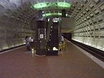
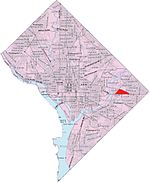
Central Northeast, also sometimes called Mahaning Heights, is a small neighborhood located in Northeast Washington, D.C. with Fort Mahan Park at its center. It is bounded by Nannie Helen Burroughs Avenue to the north, Benning Road to the south, the tracks of the Washington Metro and Minnesota Ave station to the west, and 44th Street NE to the east. It is home to the Friendship Collegiate Academy, a public charter high school. This neighborhood is part of Ward 7.
Excerpt from the Wikipedia article Central Northeast (License: CC BY-SA 3.0, Authors, Images).Central Northeast
Eads Street Northeast, Washington
Geographical coordinates (GPS) Address Nearby Places Show on map
Geographical coordinates (GPS)
| Latitude | Longitude |
|---|---|
| N 38.8955 ° | E -76.9414 ° |
Address
Eads Street Northeast 4223
20019 Washington
District of Columbia, United States
Open on Google Maps


