place

Sumner-Glenwood, Minneapolis

Neighborhoods in Minneapolis
MinneapolisSumnerGlenwoodNeighborhood

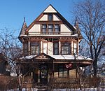
Sumner-Glenwood is a neighborhood in U.S. city of Minneapolis. It is located in the broader Near North community and the area is referred to as Heritage Park by the neighborhood association. Summer-Glenwood is roughly contained by 15 city blocks bordered to the north by 11th Avenue North, to the south by Glenwood Avenue, to the east by Interstate 94, and to the west by both Girard Terrace and Emerson Avenue North. (2)

Excerpt from the Wikipedia article Sumner-Glenwood, Minneapolis (License: CC BY-SA 3.0, Authors, Images).

Sumner-Glenwood, Minneapolis
Olson Memorial Highway, Minneapolis

Geographical coordinates (GPS) Address Nearby Places
placeShow on map

Wikipedia: Sumner-Glenwood, MinneapolisContinue reading on Wikipedia

Geographical coordinates (GPS)

Latitude Longitude
N 44.9841 ° E -93.2908 °
placeShow on map

Address

Olson Memorial Highway 851
55405 Minneapolis
Minnesota, United States
mapOpen on Google Maps

MinneapolisSumnerGlenwoodNeighborhood
Share experience

Nearby Places

Northwestern Knitting Company Factory building

The Northwestern Knitting Company Factory, also known as Munsingwear Corporation and later as International Market Square, is a former factory building in the Sumner-Glenwood neighborhood of Minneapolis, Minnesota, United States. The company was founded in 1888 by George D. Munsing, who invented a method of plating wool fibers with silk and cotton to make the union suit more comfortable. The company received financial backing from Clinton Morrison and Charles Alfred Pillsbury, who were prominent businessmen in the Minneapolis flour milling industry. This style of underwear, patented in 1891, proved to be very popular, and the company eventually became the world's largest manufacturer of underwear. The company changed its name in 1919 to Munsingwear.The company built five brick and concrete buildings between 1904 and 1915, eventually creating a complex covering 650,000 square feet (60,000 m2) and employing up to 2000 workers. The five- to eight-story buildings had long rows of windows, and although the buildings mostly had a plain appearance, the architects added some details such as slightly projecting cornices, fretwork friezes, and fluted Doric columns. The oldest of the buildings, along Glenwood Avenue, is notable for being the city's first entirely reinforced concrete building. Engineer C.A.P. Turner used concrete columns shaped like a mushroom on top, and he eventually patented this process, which was widely used.The factory eventually closed in 1981 when the economy reduced demand for Munsingwear's products. In 1985, the buildings were renovated and the complex was renamed International Market Square, which housed offices, shops, and over 100 showrooms for home and office products. The renovation included a five-story atrium created by roofing over an old courtyard where rail tracks once served the complex. In 2005, some portions of the building were renovated into 96 loft apartments. This was a leading example of adaptive reuse in Minneapolis. The building was listed on the National Register of Historic Places in 1983.

Minnesota's 5th congressional district

Minnesota's 5th congressional district is a geographically small urban and suburban congressional district in Minnesota. It covers eastern Hennepin County, including the entire city of Minneapolis, along with parts of Anoka and Ramsey counties. Besides Minneapolis, major cities in the district include St. Louis Park, Richfield, Crystal, Robbinsdale, Golden Valley, New Hope, Hopkins, Fridley, and northeast Edina. It was created in 1883, and was nicknamed the "Bloody Fifth" on account of its first election. The contest between Knute Nelson and Charles F. Kindred involved graft, intimidation, and election fraud at every turn. The Republican convention on July 12 in Detroit Lakes was compared to the historic Battle of the Boyne in Ireland. One hundred and fifty delegates fought over eighty seats. After a scuffle in the main conference center, the Kindred and Nelson campaigns nominated each of their candidates.The district is strongly Democratic, with a Cook Partisan Voting Index (CPVI) of D+26 — by far the most Democratic district in the state. The 5th is also the most Democratic district in the Upper Midwest. The Minnesota Democratic–Farmer–Labor Party (DFL) has held the seat without interruption since 1963, and the Republicans have not tallied more than 40 percent of the vote in almost half a century. The district is represented by Ilhan Omar, who is the first Somali–American to serve in the U.S. House of Representatives, and the first woman of color to represent Minnesota in that chamber. Omar, also an American Muslim, succeeded Keith Ellison, the first American Muslim to serve in Congress, after he was elected Minnesota Attorney General.

Metro (Minnesota)
Metro (Minnesota)

Metro (styled as METRO) is a transit network in Minnesota serving the cities of Minneapolis and Saint Paul. It also provides service to some suburban areas. As of 2021 the system consists of two light rail lines (Blue and Green Lines) and four bus transit lines (Orange Line, Red Line, A and C Lines) all of which are operated by the local public transit company: Metro Transit. The five lines connect Downtown Minneapolis and St Paul with the Bloomington, Minneapolis-St Paul International Airport, Roseville, Richfield, Burnsville and Brooklyn Center. Prior to August 17, 2019, service along the entire length of the Green Line operated 24/7, the only one of 22 light rail systems in the United States to do so, but a common practice on some heavy rail lines such as the New York City Subway and PATH. The service gap from 2 a.m. to 4 a.m. was replaced by bus service. Metro Transit also provides 24/7 service between the stations serving the Lindbergh and Humphrey terminals of MSP Airport; the remainder of the Blue Line operates from 3:29 a.m. to 1:54 a.m. Monday through Thursday, and 24 hours a day from 3:29 a.m. on Friday morning to 1:54 a.m. on Sunday morning.In the 1970s, roughly contemporaneous with the construction of Washington D.C.'s Metro system and San Francisco's Bay Area Rapid Transit, the newly formed Metropolitan Council contemplated the creation of a similar mass transit for the Minneapolis-St. Paul metro area, but the idea was eventually abandoned due to opposition from the Minnesota Legislature. For the next few decades, there were repeated proposals to build light rail along several corridors, particularly the University Avenue corridor between downtown Minneapolis and Saint Paul (the present Green Line), but the idea of light rail only gained steam in the late 1990s. In 1999, the Minnesota Legislature approved funding for the first line (the present Blue Line) along Hiawatha Avenue (initially named the Hiawatha Line) in south Minneapolis, which opened in 2004. In 2011, in anticipation of the opening of the Red Line and Green Line, and in order to help passengers better identify with each of the routes, Metro Transit announced that the system would be rebranded and each line assigned a unique color. The first phase of the Red Line opened in mid-2013, and the first phase of the Green Line (also known as the Central Corridor) in mid-2014. Extensions are planned to bring the system into the western metro area, with construction anticipated near the end of the decade.

Washington Avenue (Minneapolis)

Washington Avenue is a major thoroughfare in Minneapolis, Minnesota, United States. Starting north of Lowry Avenue, North Washington Avenue runs straight south, with Interstate 94 running alongside it until just south of West Broadway, when the freeway turns to the west. The street continues running straight until just south of Plymouth Avenue, where it turns in a southeasterly direction heading for Downtown Minneapolis. It forms the main thoroughfare through the Warehouse District. The scenery changes at Hennepin Avenue, where the designation changes to South Washington Avenue. This area, once known as the Gateway District, was heavily affected by urban renewal policies of the 1950s and 60s, destroying what had at one point been the heart of the city. Dozens of city blocks were bulldozed and replaced with modern glass structures - or in many cases, surface parking lots. The portion of the street from Hennepin to what is now Interstate 35W was widened and a median was added. Further changes occurred to the east of the Interstate. Washington used to turn at the Seven Corners intersection (where Washington meets Cedar Avenue) and continue across the old Washington Avenue Bridge into Southeast Minneapolis. However, the old bridge was replaced in the 1960s with a new one which meets Washington east of the Mississippi River but doesn't connect with Washington west of it, instead connecting to a short freeway stub into downtown. There is a one-block portion of the old alignment between Cedar and 19th Avenues that is branded as Washington Avenue, but to continue east of the river, one must travel down Cedar one block and turn east at 3rd Street and get on an entrance ramp to the bridge. East of the river, Washington Avenue Southeast acts as a major thoroughfare through the University of Minnesota campus; a portion of this section has been converted to a transit mall to facilitate the METRO Green Line, opened in June 2014, along with METRO bus service which ran on Washington for decades until the reconfiguration. The street continues east for six blocks before ending at SE University Avenue; the area east of Harvard Street comprises the Stadium Village district.