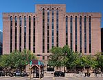
place

Fulton Beer

2008 establishments in MinnesotaBeer brewing companies based in MinnesotaFood and drink companies established in 2008Manufacturing companies based in Minneapolis

Fulton Beer is a microbrewery based in the North Loop area of Minneapolis in the U.S. state of Minnesota. The company was founded in 2009 by Ryan Petz, Jim Diley, Brian Hoffman and Peter Grande, who had been homebrewing for several years out of a garage in the Fulton neighborhood of Minneapolis. The company has also said that early 19th century American engineer and inventor Robert Fulton was the inspiration for the namesake of the brand.

Excerpt from the Wikipedia article Fulton Beer (License: CC BY-SA 3.0, Authors).

Fulton Beer
6th Avenue North, Minneapolis

Geographical coordinates (GPS) Address Website Nearby Places
placeShow on map

Wikipedia: Fulton BeerContinue reading on Wikipedia

Geographical coordinates (GPS)

Latitude Longitude
N 44.984907 ° E -93.278789 °
placeShow on map

Address

Fulton Brewery Tap Room

6th Avenue North 414
55401 Minneapolis
Minnesota, United States
mapOpen on Google Maps

Website
fultonbeer.com

linkVisit website

Share experience

Nearby Places

Metro (Minnesota)
Metro (Minnesota)

Metro (styled as METRO) is a transit network in Minnesota serving the cities of Minneapolis and Saint Paul. It also provides service to some suburban areas. As of 2021 the system consists of two light rail lines (Blue and Green Lines) and four bus transit lines (Orange Line, Red Line, A and C Lines) all of which are operated by the local public transit company: Metro Transit. The five lines connect Downtown Minneapolis and St Paul with the Bloomington, Minneapolis-St Paul International Airport, Roseville, Richfield, Burnsville and Brooklyn Center. Prior to August 17, 2019, service along the entire length of the Green Line operated 24/7, the only one of 22 light rail systems in the United States to do so, but a common practice on some heavy rail lines such as the New York City Subway and PATH. The service gap from 2 a.m. to 4 a.m. was replaced by bus service. Metro Transit also provides 24/7 service between the stations serving the Lindbergh and Humphrey terminals of MSP Airport; the remainder of the Blue Line operates from 3:29 a.m. to 1:54 a.m. Monday through Thursday, and 24 hours a day from 3:29 a.m. on Friday morning to 1:54 a.m. on Sunday morning.In the 1970s, roughly contemporaneous with the construction of Washington D.C.'s Metro system and San Francisco's Bay Area Rapid Transit, the newly formed Metropolitan Council contemplated the creation of a similar mass transit for the Minneapolis-St. Paul metro area, but the idea was eventually abandoned due to opposition from the Minnesota Legislature. For the next few decades, there were repeated proposals to build light rail along several corridors, particularly the University Avenue corridor between downtown Minneapolis and Saint Paul (the present Green Line), but the idea of light rail only gained steam in the late 1990s. In 1999, the Minnesota Legislature approved funding for the first line (the present Blue Line) along Hiawatha Avenue (initially named the Hiawatha Line) in south Minneapolis, which opened in 2004. In 2011, in anticipation of the opening of the Red Line and Green Line, and in order to help passengers better identify with each of the routes, Metro Transit announced that the system would be rebranded and each line assigned a unique color. The first phase of the Red Line opened in mid-2013, and the first phase of the Green Line (also known as the Central Corridor) in mid-2014. Extensions are planned to bring the system into the western metro area, with construction anticipated near the end of the decade.

North Loop, Minneapolis

The North Loop, also commonly called The Warehouse District, is a neighborhood of the Central community of Minneapolis, Minnesota that was Minneapolis’s main commercial district during the city's years as a midwestern shipping hub. Although only a little commercial shipping is still done in the neighborhood, the historic warehouses still dominate the neighborhood. Some of these buildings have been repurposed into restaurants, shops, and apartments. Because of this identity, the neighborhood is commonly known as the Warehouse District. It includes the Minneapolis Warehouse Historic District which is listed on the National Register of Historic Places. The North Loop is located northwest of the central business district between downtown Minneapolis and the Mississippi River. Streets in the North Loop are oriented to be parallel to the river, which means that they run at a 45-degree angle relative to the grid of the rest of the city. Although the neighborhood technically extends further to the south, the main residential and commercial area of the North Loop is roughly a rectangle bounded by the railroad tracks as Cedar Lake Trail (in the southeast), Plymouth Avenue (in the northwest), the elevated 4th street freeway entrance/exit in the southwest, and the Mississippi River in the northeast. Washington Avenue is the main thoroughfare through the neighborhood. The James I. Rice Park, which is in the northeast portion of the neighborhood along the river, is popular with residents during the summer months. The bike trail and West River Parkway that runs through the park are part of the Grand Rounds Scenic Byway. The park added a playground in 2010 located where 4th Ave North intersects with West River Parkway.

Traffic Zone Center for Visual Art

The Traffic Zone Center for Visual Art (TZCVA) is an artist cooperative located in the historic Warehouse District of downtown Minneapolis, Minnesota, United States. Founded in 1993, TZCVA was established to create an artist-owned and managed building that provides stable, safe, and affordable studio, teaching and exhibition space for mid-career visual artists. TZCVA is a partnership between Artspace Projects, Inc., a leading national non-profit real estate developer for the arts, and a cooperative of 23 artist-members. TZCVA is housed in a restored six-story Chicago-style limestone warehouse located in the North Loop neighborhood at 250 Third Avenue North, Minneapolis, Minnesota, 55401. The Traffic Zone building is of significant historic and architectural interest and is listed on the National Register of Historic Places (NRHP). Erected in 1886 for the Moline, Milburn and Stoddard Company as a warehouse for storing farm machinery and implements, the building was expanded two years later and converted into a commercial bakery operated by the National Biscuit Company (Nabisco). From 1951 to 1992, it housed an appliance parts business. In 1992, the warehouse was purchased by Artspace Projects with financial assistance from the City of Minneapolis, the McKnight Foundation, the Dayton Hudson Foundation, the General Mills Foundation and other funders. Extensively renovated by LHB Engineers & Architects (Minneapolis), the restored warehouse re-opened in 1995 as the Traffic Zone Center for Visual Art.Members of the TZCVA cooperative have included an eclectic, international mix of painters, photographers, printmakers, conceptual artists, sculptors, book artists, and ceramicists. Many are past recipients of fellowships and grants from the McKnight Foundation (Minneapolis); the Bush Foundation (St. Paul); the Jerome Foundation (New York & St. Paul); the Minnesota State Arts Board (St. Paul); the Pollock-Krasner Foundation, (New York); and the National Endowment for the Arts (Washington, D.C.). As part of its community-oriented educational mission, TZCVA sponsors workshops, classes, presentations, and quarterly exhibitions of contemporary art by local, national, and international painters, sculptors, photographers, printmakers, book artists, and installation artists. Organized by co-op artists and guest curators, these exhibitions are presented in the Traffic Zone Gallery, the cooperative's ground floor exhibition space. TZCVA also hosts semi-annual "Open Studio" events to allow members of the community to meet co-op artists and view and purchase artwork in a studio setting. Current TZCVA artist-members include Harriet Bart, Kristie Bretzke, Perci Chester, David Collins, Lisa Colwell, James Conaway, Jim Dryden, Jil Evans, Bette Globus Goodman, Bonnie Heller, Bruce Hudson-Bogaard, Vesna Kittelson, Paul Ka Yin Kwok, Lisa Nankivil, Jon Neuse, Howard Oransky, Steve Ozone, Rebecca Pavlenko, Patrick Kemal Pryor, Jodi Reeb, Wilber H. Schilling, Harold B. Stone, and Jantje Visscher. Commercial and non-profit building tenants include Artspace Projects, Inc., Graywolf Press, Indulgence Press, James & Mary Laurie Booksellers, Pro-Choice Resources, among others.

Butler Square
Butler Square

Butler Square (originally the Butler Brothers Company building) is a former warehouse and office building in Minneapolis, Minnesota, United States. The building is located within the Minneapolis warehouse district and was listed on the National Register of Historic Places in 1971. It is significant for its restrained Chicago School design by major Minneapolis architect Harry Wild Jones, and as a leading example of the older warehouse/office buildings in Minneapolis–Saint Paul. Jones designed other buildings in Minneapolis such as the Minneapolis Scottish Rite Temple, Calvary Baptist Church, the Lakewood Cemetery Chapel, and the Washburn Park Water Tower.It was originally built as a warehouse for Butler Brothers, a mail-order firm, on the land that formerly housed the Athletic Park baseball stadium. It had rather heavy construction in keeping with its function as a warehouse, featuring thick interior masonry walls with thin, recessed windows topped by corbelled parapets. The interior is built with heavy timber posts and beams, cut from Douglas fir grown near Aitkin, Minnesota. The columns are 24 inches (61 cm) wide at the bottom level, gradually diminishing to 9 inches (23 cm) wide on the top level. The basement included a horse stable, to accommodate deliveries, and the building had three large coal-fired boilers for heating. Mechanical elevators were used to move goods throughout the building. The building had a rail spur to facilitate boxcar loading. Gradually, as truck transportation became more competitive with rail transportation, the urban location of the building rendered it inefficient as a warehouse.In 1972 real estate developer Charles Coyer purchased the building with plans to rebuild the east half of the building as an office-retail complex. As part of the renovation, a central atrium in the eastern half of the building was built to allow natural light into the building. This made the retail and office space more marketable, since the large floor space and small windows made it difficult to get enough natural light into the interior. James H. Binger purchased the building in 1979 with similar plans to develop the west half of the building. The atrium on western side was built with more of the heavy timber construction exposed, and more efficient mechanical systems were installed. The renovation of the building has served as a catalyst for additional development and preservation within the Minneapolis Warehouse District.

Washington Avenue (Minneapolis)

Washington Avenue is a major thoroughfare in Minneapolis, Minnesota, United States. Starting north of Lowry Avenue, North Washington Avenue runs straight south, with Interstate 94 running alongside it until just south of West Broadway, when the freeway turns to the west. The street continues running straight until just south of Plymouth Avenue, where it turns in a southeasterly direction heading for Downtown Minneapolis. It forms the main thoroughfare through the Warehouse District. The scenery changes at Hennepin Avenue, where the designation changes to South Washington Avenue. This area, once known as the Gateway District, was heavily affected by urban renewal policies of the 1950s and 60s, destroying what had at one point been the heart of the city. Dozens of city blocks were bulldozed and replaced with modern glass structures - or in many cases, surface parking lots. The portion of the street from Hennepin to what is now Interstate 35W was widened and a median was added. Further changes occurred to the east of the Interstate. Washington used to turn at the Seven Corners intersection (where Washington meets Cedar Avenue) and continue across the old Washington Avenue Bridge into Southeast Minneapolis. However, the old bridge was replaced in the 1960s with a new one which meets Washington east of the Mississippi River but doesn't connect with Washington west of it, instead connecting to a short freeway stub into downtown. There is a one-block portion of the old alignment between Cedar and 19th Avenues that is branded as Washington Avenue, but to continue east of the river, one must travel down Cedar one block and turn east at 3rd Street and get on an entrance ramp to the bridge. East of the river, Washington Avenue Southeast acts as a major thoroughfare through the University of Minnesota campus; a portion of this section has been converted to a transit mall to facilitate the METRO Green Line, opened in June 2014, along with METRO bus service which ran on Washington for decades until the reconfiguration. The street continues east for six blocks before ending at SE University Avenue; the area east of Harvard Street comprises the Stadium Village district.