Charmant Som

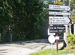
Charmant Som is a mountain in the French department of Isère, rising to 1,867 metres (6,125 ft) in the Chartreuse Mountains in the Alps. It is made up of limestone, but its relief is less pronounced than that of the surrounding mountains, which is why it is covered with alpine meadows, the origin of its name. These have been occupied and tended by shepherds since the Middle Ages. They are accessible via a road built between the two world wars from the Col de Porte to 200 metres (660 ft) below the main summit. The road leads to two buildings serving as inn, chalet and cheese dairy. The mountain is part of the Chartreuse Regional Nature Park, a Natural area of ecological, faunal and floristic interest (ZNIEFF by its acronym in French) and a Natura 2000 zone. These protected areas are designed to preserve biodiversity. However, they are also ideal for hiking, speleology (which began to develop in the 1960s, followed by skiing in the late 1970s), cycling, climbing and paragliding.
Excerpt from the Wikipedia article Charmant Som (License: CC BY-SA 3.0, Authors, Images).Charmant Som
Chemin des Combes, Grenoble
Geographical coordinates (GPS) Address Nearby Places Show on map
Geographical coordinates (GPS)
| Latitude | Longitude |
|---|---|
| N 45.325 ° | E 5.7641666666667 ° |
Address
Chemin des Combes
38380 Grenoble
Auvergne-Rhône-Alpes, France
Open on Google Maps


