Col de Palaquit
IsèreMountain passes of Auvergne-Rhône-Alpes

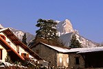
The Col de Palaquit (altitude 1,154 m (3,786 ft)) is a mountain pass situated in the Chartreuse Mountains in the Isère department of France, near the village of Sarcenas. The Tour de France cycle race crossed the col for the first time on Stage 13 of the 2014 race. The pass is located on the climb via the D512 from Grenoble to the Col de Porte which has been used regularly by the Tour de France.
Excerpt from the Wikipedia article Col de Palaquit (License: CC BY-SA 3.0, Authors, Images).Col de Palaquit
D 512, Grenoble
Geographical coordinates (GPS) Address Nearby Places Show on map
Geographical coordinates (GPS)
| Latitude | Longitude |
|---|---|
| N 45.272777777778 ° | E 5.7655555555556 ° |
Address
D 512
38700 Grenoble
Auvergne-Rhône-Alpes, France
Open on Google Maps


