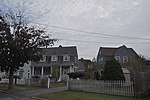
Dartmouth (Massachusett: Apponeganset) is a coastal town in Bristol County, Massachusetts. Old Dartmouth was the first area of Southeastern Massachusetts to be settled by Europeans, primarily English. Dartmouth is part of New England's farm coast, which consists of a chain of historic coastal villages, vineyards, and farms. June 8, 2014 marked the 350th year of Dartmouth's incorporation as a town. It is also part of the Massachusetts South Coast. The local weekly newspapers are The Dartmouth/Westport Chronicle and Dartmouth Week. The Portuguese municipality of Lagoa is twinned with the town; along with several other Massachusetts and Rhode Island towns and cities around Bristol County.The northern part of Dartmouth has the town's large commercial districts. The southern part of town abuts Buzzards Bay, and there are several other waterways, including Lake Noquochoke, Cornell Pond, Slocums River, Shingle Island River and Paskamansett River. The town has several working farms and one vineyard, which is part of the Coastal Wine Tour. With a thriving agricultural heritage, the town and state have protected many of the working farms.
The southern part of Dartmouth borders Buzzards Bay, where a lively fishing and boating community thrives; off its coast, the Elizabeth Islands and Cuttyhunk can be seen. The New Bedford Yacht Club in Padanaram hosts a bi-annual regatta. The town's unique historic villages and selection of coastal real estate have made it a destination for generations as a summering community. Notable affluent sections within South Dartmouth are Nonquitt, Round Hill, Barney's Joy, and Mishaum Point. It also has many year-round residents and a variety of activities throughout the year. As of the 2020 census, the year-round population of Dartmouth was 33,783.Dartmouth is the third-largest town (by land area) in Massachusetts, after Plymouth and Middleborough. The distance from Dartmouth's northernmost border with Freetown to Buzzards Bay in the south is approximately 16 miles (26 km). The villages of Hixville, Bliss Corner, Padanaram, Smith Mills, and Russells Mills are located within the town. Dartmouth shares borders with Westport to the west, Freetown and Fall River to the north, Buzzards Bay to the south, and New Bedford to the east. Boat shuttles provide regular transportation daily to Martha's Vineyard and Cuttyhunk Island.
The origin of the name is considered to be named after Dartmouth, England. This could have been because Bartholomew Gosnold, the first European to explore the land, sailed to America on a ship from Dartmouth in England. It could have been also named Dartmouth to commemorate when the Pilgrims stopped in Dartmouth for ship repairs.Catholic churches in Dartmouth are part of the Diocese of Fall River in the New Bedford Deanery. Catholic Churches in Dartmouth include St. Marys Parish which was founded in 1930 as a country Parish before growing to fulfill the needs of the town. St. Julie Billiart Parish which was established in 1969 and is Directly Adjacent to Bishop Stang High School, a Catholic High School. And St. George Parish in Westport, Massachusetts also covers portions of the town of Dartmouth and was founded in 1914.


