place

Hazelwood Park (New Bedford, Massachusetts)

Bristol County, Massachusetts Registered Historic Place stubsBuildings and structures completed in 1840Gothic Revival architecture in MassachusettsNational Register of Historic Places in New Bedford, MassachusettsNew Bedford, Massachusetts
Parks in Bristol County, MassachusettsQueen Anne architecture in Massachusetts
NewBedfordMA HazelwoodPark CongdonHouse 1

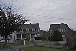
Hazelwood Park is a public park on Clark's Point in New Bedford, Massachusetts. The park occupies a plot of 23 acres (9.3 ha) on the west side of New Bedford's southern peninsula, between Rodney French Boulevard and Brock Avenue. It overlooks Clark's Cove which opens into Buzzards Bay. The park was listed on the National Register of Historic Places in 2010.The park's origins lie in three country estates, which were established in the area during the 19th century. It takes its name from the estate of Joseph Congdon, whose 1839-40 Gothic Revival house stands near the center of the park. Congdon named his estate "Hazelwood", and built an English garden on the then-forested Clark's Point peninsula. The park also has two later houses: the Coffin-Howland House, which may contain portions of Congdon's carriage house, is fire-damaged and fenced off, and the Howland House, built in 1890, is located near Brock Avenue, and is dominated by its large carriage house and stable. By the late 1890s, development had encroached on the area, and the city of New Bedford was purchasing land for use as public parks. It acquired the Hazelwood property in 1902. It hired Warren Manning, who had previously worked for Frederick Law Olmsted, to plan the park.

Excerpt from the Wikipedia article Hazelwood Park (New Bedford, Massachusetts) (License: CC BY-SA 3.0, Authors, Images).

Hazelwood Park (New Bedford, Massachusetts)
Brock Avenue, New Bedford

Geographical coordinates (GPS) Address Nearby Places
placeShow on map

Wikipedia: Hazelwood Park (New Bedford, Massachusetts)Continue reading on Wikipedia

Geographical coordinates (GPS)

Latitude Longitude
N 41.606 ° E -70.914 °
placeShow on map

Address

Congdon-Lucan House

Brock Avenue 597
02744 New Bedford
Massachusetts, United States
mapOpen on Google Maps

NewBedfordMA HazelwoodPark CongdonHouse 1
Share experience

Nearby Places

Acushnet Fort

Acushnet Fort was a fort that existed from 1776 to around 1820 on Eldridge Point in New Bedford, Massachusetts. It was originally built with Commonwealth resources during the American Revolution in 1776 with ten guns. Rebuilt in 1808 under the federal second system of fortifications, it could accommodate 40 men and had six guns and a magazine.The fort's exact location, especially in the Revolution, is uncertain. The fort appears in the Secretary of War's reports for 1808 and 1811; thus it was a federal fort at that time. In 1808 the entry is: "At the entrance of the inner harbor of New Bedford, two miles below the town, a small enclosed work has been erected of stone, brick, and sod. It commands the entrance into the harbor for a mile and a half in a direct line...". In 1811 the entry is: "At Eldridge Point, which commands the entrance of the harbor; an enclosed work of masonry, mounting six heavy guns...". The "two miles below the town" implies the fort was at or near Clark's Point, later the site of Fort Rodman. Another possibility is the area of Fairhaven known as Poverty Point or Oxford Point, part of which was once owned by the Eldredge family, although this is north of the harbor entrance. Fairhaven was part of New Bedford until 1812.A list of fort commanders shows that the Eldridge Point fort was commanded by Captain James Thomas of the Dragoons in 1810–1811, followed by 1st Lt. Henry Whiting, also of the Dragoons, in 1811–1812.By the time Fort Rodman was built in the 1850s, the fort no longer existed.

Fort Phoenix
Fort Phoenix

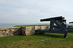
Fort Phoenix is a former American Revolutionary War-era fort located at the entrance to the Fairhaven-New Bedford harbor, south of U.S. 6 in Fort Phoenix Park in Fairhaven, Massachusetts. The fort was originally built in 1775 without a name, and added to the National Register of Historic Places in 1972. Just off the fort, in Buzzards Bay, was the first naval engagement of the American Revolution, the Battle off Fairhaven on 14 May 1775.On 5–6 September 1778, the fort was destroyed by the British when they raided the harbor. A force under Major Israel Fearing drove off the British, both at the fort and when they attempted an attack on the town the next day. The fort was then renamed Fort Fearing. In 1784 it was given the name "Fort Phoenix" after the mythical bird that rose from its own ashes. The fort was rebuilt in 1798, and rebuilt again in 1808 with 12 guns with Commonwealth resources, contemporary with but not part of the second system of US fortifications.In the War of 1812, HMS Nimrod bombarded the fort on 13 June 1814 when the local militia refused to surrender some guns. After an exchange of fire Nimrod sailed away. Local accounts differ as to whether she launched boats carrying a landing party that were driven off, or not. This event is confused in some references with an attack by the same ship on Falmouth on 29 January 1814.The fort currently has five iron cannons mounted on reproduction wooden carriages. The cannons are Model 1819 24-pounders. Their trunnions are marked, “W.F.” on one side and “1828” on the opposite side, indicating they were cast at the West Point Foundry in Cold Spring, New York, in the year 1828. They were installed at the fort sometime before the Civil War along with three similar guns which were later transferred out of the fort near the end of the war. There is also a smaller cannon at the fort which was captured by the Continental Marines during the raid on Nassau in the Bahamas in 1776. This raid was the first amphibious landing on foreign soil by United States Marines. This gun has been in Fairhaven since about 1777 and one of those originally installed when the fort was built. In recent years, two more cannons, mounted on field artillery carriages have been installed at the fort. Donated to the Town of Fairhaven by the New Bedford Whaling Museum, the barrels of the guns are thought to date to the War of 1812, but they have no direct connection to Fort Phoenix. The fort was rebuilt with a new powder magazine and regarrisoned with eight guns in the Civil War.During World War II an Anti-Motor Torpedo Boat (AMTB) battery of four towed 37 mm guns was at the fort.Today, historical encampments are staged at Fort Phoenix in the spring and fall by a local reenacting group, the Fairhaven Village Militia.