Chastleton
AC with 0 elementsCivil parishes in OxfordshireUse British English from August 2015Villages in OxfordshireWest Oxfordshire District

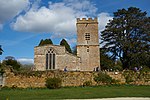
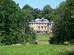
Chastleton is a village and civil parish in the Cotswold Hills in Oxfordshire, England, about 4 miles (6.4 km) northeast of Stow-on-the-Wold. Chastleton is in the extreme northwest of Oxfordshire, on the boundaries with both Gloucestershire and Warwickshire. The 2011 Census recorded the parish's population as 153.
Excerpt from the Wikipedia article Chastleton (License: CC BY-SA 3.0, Authors, Images).Chastleton
West Oxfordshire
Geographical coordinates (GPS) Address Nearby Places Show on map
Geographical coordinates (GPS)
| Latitude | Longitude |
|---|---|
| N 51.963 ° | E -1.642 ° |
Address
GL56 0SU West Oxfordshire
England, United Kingdom
Open on Google Maps


