Adlestrop

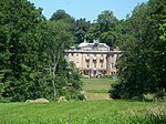
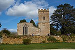
Adlestrop () is a village and civil parish in the Cotswolds, 3 miles (5 km) east of Stow-on-the-Wold, Gloucestershire, England, on the county boundary with Oxfordshire. The River Evenlode forms the southwest boundary of the parish. The village is on a stream that flows southwest to join the river. The A436 road, which links the A44 road in Oxfordshire with Stow-on-the-Wold, passes through the parish just south of the village. The Cotswold Line railway passes along the Evenlode valley southwest of the village and until 1966 had a station here. Since 1935 the parish of Adlestrop has included the village of Daylesford. The 2011 Census recorded the parish population as 120.
Excerpt from the Wikipedia article Adlestrop (License: CC BY-SA 3.0, Authors, Images).Adlestrop
Evenlode Road, Cotswold District Evenlode
Geographical coordinates (GPS) Address Nearby Places Show on map
Geographical coordinates (GPS)
| Latitude | Longitude |
|---|---|
| N 51.944333 ° | E -1.65 ° |
Address
Evenlode Road
Evenlode Road
GL56 0YR Cotswold District, Evenlode
England, United Kingdom
Open on Google Maps


