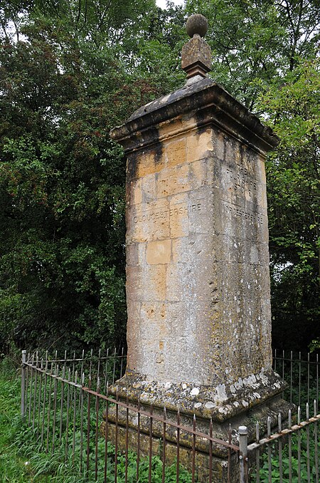
Four Shire Stone
18th-century architecture in the United KingdomBoundary markersCotswold DistrictGeography of GloucestershireGeography of Oxfordshire ... and 14 more
Geography of WarwickshireGeography of WorcestershireGrade II listed buildings in GloucestershireGrade II listed buildings in OxfordshireGrade II listed buildings in WarwickshireHistory of WorcestershireMonumental columns in the United KingdomMonuments and memorials in GloucestershireMonuments and memorials in OxfordshireMonuments and memorials in WarwickshireMoreton-in-MarshQuadripoints and higherStratford-on-Avon DistrictWest Oxfordshire District

The Four Shire Stone is a boundary marker that marks the place where the four historic English counties of Warwickshire, Oxfordshire, Gloucestershire, and Worcestershire once met. Since 1931, with a change to the boundaries of Worcestershire, only three of the counties meet at the stone.
Excerpt from the Wikipedia article Four Shire Stone (License: CC BY-SA 3.0, Authors, Images).Four Shire Stone
Stratford-on-Avon Great Wolford
Geographical coordinates (GPS) Address Nearby Places Show on map
Geographical coordinates (GPS)
| Latitude | Longitude |
|---|---|
| N 51.9875 ° | E -1.6658333333333 ° |
Address
CV36 5NQ Stratford-on-Avon, Great Wolford
England, United Kingdom
Open on Google Maps


