Arbury Hill
Highest points of English countiesHill forts in NorthamptonshireHills of Northamptonshire

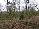
Arbury Hill, at 225 m (738 ft), is the joint highest point in the English county of Northamptonshire. It is 9 km (5.6 mi) southwest of the town of Daventry. The slopes of Arbury Hill are a drainage divide between three major river catchment areas, with the Nene to the north, east and south, the Cherwell (a tributary of the Thames) to the south-west and the Leam (a tributary of the Severn) to the west and north-west. There are fine views with Rugby and Coventry visible to the northwest and Northampton to the east. The River Nene rises in a swampy hollow on the northwestern flanks of the hill.
Excerpt from the Wikipedia article Arbury Hill (License: CC BY-SA 3.0, Authors, Images).Arbury Hill
Badby Road,
Geographical coordinates (GPS) Address Nearby Places Show on map
Geographical coordinates (GPS)
| Latitude | Longitude |
|---|---|
| N 52.2243 ° | E -1.2101 ° |
Address
Badby Road
NN11 3FP , Badby
England, United Kingdom
Open on Google Maps


