Charwelton
Civil parishes in NorthamptonshireUse British English from March 2014Villages in NorthamptonshireWest Northamptonshire District

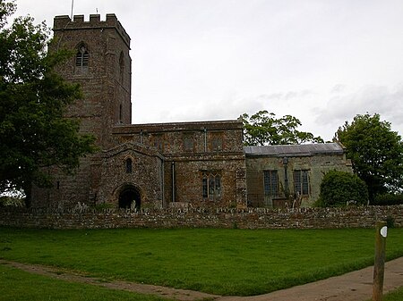
Charwelton is a village and civil parish about 5 miles (8 km) south of Daventry in Northamptonshire, England. The 2011 Census recorded the parish's population (including Fawsley) as 220.The villages name means 'River Cherwell farm/settlement'.The present village, formerly called Upper or Over Charwelton, is where the main road between Daventry and Banbury, now the A361 road, crosses the river. The parish church is almost 1 mile (2 km) southeast at Church Charwelton, which is a hamlet and deserted medieval village.The Jurassic Way long distance footpath between Banbury and Stamford passes through both Church Charwelton and Upper Charwelton.[1]
Excerpt from the Wikipedia article Charwelton (License: CC BY-SA 3.0, Authors, Images).Charwelton
Church Street,
Geographical coordinates (GPS) Address Nearby Places Show on map
Geographical coordinates (GPS)
| Latitude | Longitude |
|---|---|
| N 52.195 ° | E -1.219 ° |
Address
Church Street
Church Street
NN11 3YT , Charwelton
England, United Kingdom
Open on Google Maps


