place

Lower Catesby

Use British English from March 2014Villages in NorthamptonshireWest Northamptonshire District
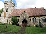
Lower Catesby geograph.org.uk 182896

Lower Catesby is a hamlet in the civil parish of Catesby, Northamptonshire, about 4 miles (6.4 km) southwest of Daventry. Lower Catesby is beside the nascent River Leam, which rises about 1 mile (1.6 km) to the south in the parish of Hellidon. The Jurassic Way long-distance footpath passes through Lower Catesby. The population of the hamlet is included in the civil parish of Hellidon. The hamlets name means 'Katr's/Kati's farm/settlement'.

Excerpt from the Wikipedia article Lower Catesby (License: CC BY-SA 3.0, Authors, Images).

Lower Catesby
Lower Catesby Gated Road,

Geographical coordinates (GPS) Address Nearby Places
placeShow on map

Wikipedia: Lower CatesbyContinue reading on Wikipedia

Geographical coordinates (GPS)

Latitude Longitude
N 52.2313 ° E -1.2474 °
placeShow on map

Address

Lower Catesby Gated Road
NN11 6LF , Catesby
England, United Kingdom
mapOpen on Google Maps

Lower Catesby geograph.org.uk 182896
Share experience

Nearby Places

Flecknoe
Flecknoe

Flecknoe is a village in the Rugby district of Warwickshire, England, one mile west of the border with Northamptonshire. The village is the largest settlement within the civil parish of Wolfhampcote, and has a population of around 200. The village was mentioned in the Domesday Book as Flachenho, probably meaning "Flecca's hill". The village is shown as Fleckno on the Christopher Saxton map of 1637. Flecknoe is quite an isolated village, it is located on a hill called Bush Hill, one mile north of the nearest main road (the A425 road Southam - Daventry road) and is connected only by narrow lanes. Flecknoe has a small church, dedicated to St. Mark, which was built in 1891. An older chapel in the village dating from 1837 is now a private house. The village formerly had a school, which is now the village hall. On the outskirts of the village is a derelict brick building which is attributed to be the remains of a Second World War camp. The village also has an Edwardian pub called the Old Olive Bush.The Grand Union Canal runs in the plain to the north of the village, which also contains the remain of the former Weedon to Leamington railway line. Flecknoe once had a railway station on this line. The station was over a mile north of the village and effectively in the middle of nowhere, consequently it was an early victim of British Railways' closure programme, the last passenger train running on 3 November 1952. However, the line survived carrying freight until 2 December 1963. To the east of the village are the remains of the former Great Central Main Line. Around half a mile to the north of Flecknoe is the tiny hamlet of Nethercote.