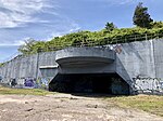
Barren Island, Brooklyn
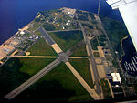
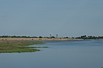
Barren Island is a peninsula and former island on the southeast shore of Brooklyn in New York City. Located on Jamaica Bay, it was geographically part of the Outer Barrier island group on the South Shore of Long Island. The island was occupied by the Lenape Native Americans prior to the arrival of Dutch settlers in the 17th century. Its name is a corruption of Beeren Eylandt, the Dutch-language term for "Bears' Island". Barren Island remained sparsely inhabited before the 19th century, mainly because of its relative isolation from the rest of the city. Starting in the 1850s, the island was developed as an industrial complex with fish rendering plants and other industries, and also as an ethnically diverse community of up to 1,500 residents. Between the mid-19th century and 1934, the island housed industrial plants that processed the carcasses of the city's dead horses, converting them into a variety of industrial products. This activity led to the still-extant waterbody on the island's western shore becoming nicknamed "Dead Horse Bay". A garbage incinerator, which became the subject of numerous complaints because of its odor, operated on the island from the 1890s to 1921. The Barren Island community became known as South Flatlands during its final years. By the 1920s, most of the industrial activity had tapered off, and landfill was used to unite the island with the rest of Brooklyn. While most residents were evicted in the late 1920s for the construction of Floyd Bennett Field, some were permitted to stay until 1942, when the airfield was expanded as a wartime base of the United States Navy. No trace remains of the former island's industrial use. Since 1972, Floyd Bennett Field has been part of the Gateway National Recreation Area, managed by the National Park Service.
Excerpt from the Wikipedia article Barren Island, Brooklyn (License: CC BY-SA 3.0, Authors).Barren Island, Brooklyn
Compass Rose, New York Brooklyn
Geographical coordinates (GPS) Address Nearby Places Show on map
Geographical coordinates (GPS)
| Latitude | Longitude |
|---|---|
| N 40.592777777778 ° | E -73.893055555556 ° |
Address
Floyd Bennett Field Historic District
Compass Rose
11697 New York, Brooklyn
New York, United States
Open on Google Maps
