Nashua River Rail Trail
2002 establishments in MassachusettsBoston and Maine RailroadNashua, New HampshireParks in Middlesex County, MassachusettsProtected areas established in 2002 ... and 2 more
Rail trails in MassachusettsRail trails in New Hampshire

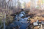
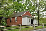
The Nashua River Rail Trail is a 12.5-mile (20.1 km) paved mixed-use rail trail in northern Massachusetts and southern New Hampshire under control of the Massachusetts Department of Conservation and Recreation (DCR). It roughly follows the course of the Nashua River, passing through the towns of Ayer, Groton, Pepperell, and Dunstable, Massachusetts and ends about a mile across the New Hampshire state border in Nashua, New Hampshire. The trail is used by walkers, cyclists, inline skaters, equestrians, and cross-country skiers.
Excerpt from the Wikipedia article Nashua River Rail Trail (License: CC BY-SA 3.0, Authors, Images).Nashua River Rail Trail
Nashua River Rail Trail,
Geographical coordinates (GPS) Address Nearby Places Show on map
Geographical coordinates (GPS)
| Latitude | Longitude |
|---|---|
| N 42.65 ° | E -71.576666666667 ° |
Address
Nashua River Rail Trail
Nashua River Rail Trail
01363
Massachusetts, United States
Open on Google Maps


