Chalvington with Ripe
Civil parishes in East SussexWealden District

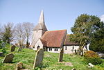
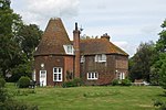
The civil parish of Chalvington with Ripe, in the Wealden District of East Sussex, England, is made up of the two villages, Chalvington and Ripe. They are located in the upper Rivers Cuckmere and Ouse joint valley north of the South Downs, between the A27 and the A22 roads, and some 15 miles (24 km) north-west of Eastbourne. Ripe is the larger of the two ecclesiastical parishes with 1,120 acres (450 hectares), compared to the 729 acres (295 hectares) of Chalvington. The civil parish was formed on 1 April 1999 from "Chalvington" and "Ripe" parishes.
Excerpt from the Wikipedia article Chalvington with Ripe (License: CC BY-SA 3.0, Authors, Images).Chalvington with Ripe
Church Farm Lane, Wealden Chalvington with Ripe
Geographical coordinates (GPS) Address Nearby Places Show on map
Geographical coordinates (GPS)
| Latitude | Longitude |
|---|---|
| N 50.864436 ° | E 0.159125 ° |
Address
Church Farm Lane
Church Farm Lane
BN27 3TD Wealden, Chalvington with Ripe
England, United Kingdom
Open on Google Maps


