Berwick, East Sussex
Civil parishes in East SussexVillages in East SussexWealden District

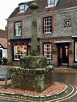
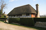
Berwick (pronounced BUR-wik or, more recently, BERR-ik) is a village and civil parish in the Wealden district of East Sussex in England. The village lies immediately to the south of the A27 road between Lewes and Polegate, about three miles (4.8 km) west of the latter. The parish is located in the River Cuckmere floodplain, north of the South Downs. The place-name 'Berwick' is here first attested in the Domesday Book of 1086, where it appears as Berewice. The name means 'corn farm'.There are two public houses in the parish: the Berwick Inn near the railway station, and The Cricketers, in the village itself. The village also has an example of a "K6" red telephone box.
Excerpt from the Wikipedia article Berwick, East Sussex (License: CC BY-SA 3.0, Authors, Images).Berwick, East Sussex
A27, Wealden Berwick
Geographical coordinates (GPS) Address Nearby Places Show on map
Geographical coordinates (GPS)
| Latitude | Longitude |
|---|---|
| N 50.83 ° | E 0.15 ° |
Address
A27
BN26 6SN Wealden, Berwick
England, United Kingdom
Open on Google Maps


