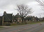
Borough of Gedling
GedlingNon-metropolitan districts of NottinghamshireUse British English from November 2014

Gedling is a local government district with borough status in Nottinghamshire, England, whose council is based in Arnold, north-east of Nottingham. The population at the time of the 2011 census was 113,543.It was formed on 1 April 1974 by merging the urban districts of Arnold and Carlton and part of the rural district of Basford. It is named after the village of Gedling. Other settlements include Burton Joyce, Calverton, Colwick and Ravenshead.
Excerpt from the Wikipedia article Borough of Gedling (License: CC BY-SA 3.0, Authors, Images).Borough of Gedling
Main Road, Nottingham Gedling
Geographical coordinates (GPS) Address Nearby Places Show on map
Geographical coordinates (GPS)
| Latitude | Longitude |
|---|---|
| N 52.97531 ° | E -1.07597 ° |
Address
Main Road 77
NG4 3HD Nottingham, Gedling
England, United Kingdom
Open on Google Maps


