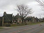
Gedling

Gedling is a village in the Gedling district, in Nottinghamshire, England, four miles northeast of Nottingham city centre. The population at the 2011 census of the ward was 6,817 and 111,787 for the district. Gedling is still a distinct settlement, having been recorded in the Domesday Book, although due to the growth of residential, commercial and industrial in the wider Gedling Borough, City of Nottingham, Borough of Broxtowe, Rushcliffe and Ashfield District. As well as the Amber Valley and Borough of Erewash in Derbyshire which have become quite urban around Nottingham. It can be difficult to separate its distinction from the town of Carlton which has become contiguous with it.
Excerpt from the Wikipedia article Gedling (License: CC BY-SA 3.0, Authors, Images).Gedling
Main Road, Nottingham Gedling
Geographical coordinates (GPS) Address Nearby Places Show on map
Geographical coordinates (GPS)
| Latitude | Longitude |
|---|---|
| N 52.975 ° | E -1.081 ° |
Address
Main Road 51
NG4 3HS Nottingham, Gedling
England, United Kingdom
Open on Google Maps


