East Runton

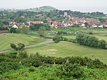
East Runton is a small village in Norfolk, England situated close to the North Sea. It was once a traditional fishing village outside Cromer but is now a popular holiday destination for camping and caravan holidays. The village is within the parish of Runton that also includes West Runton. The village is 1.3 miles (2.1 km) west of Cromer, 1.7 miles (2.7 km) east of West Runton, 2.7 miles (4.3 km) east of Sheringham and 21.7 miles (34.9 km) north of Norwich. The village lies on the A149 coast road but most of the dwellings can be found just south of the road, nestled around the two village greens. The population in the 2001 census was shown as 1,633 (includes West Runton) in 784 households. At the 2011 census the population was included in the civil parish of Runton. The parish area is 544 hectares. The war dead of East Runton are recorded on the West Runton War Memorial. The villages name means either, Runa's farm/settlement' or 'Runi's farm/settlement'.
Excerpt from the Wikipedia article East Runton (License: CC BY-SA 3.0, Authors, Images).East Runton
Cromer Road, North Norfolk Runton
Geographical coordinates (GPS) Address Website Nearby Places Show on map
Geographical coordinates (GPS)
| Latitude | Longitude |
|---|---|
| N 52.94 ° | E 1.24 ° |
Address
Kingswood Norfolk Residential and Activity Centre
Cromer Road
NR27 9NF North Norfolk, Runton
England, United Kingdom
Open on Google Maps


