West Runton Cliffs
Geological Conservation Review sitesSites of Special Scientific Interest in Norfolk

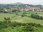
West Runton Cliffs is a 17.8-hectare (44-acre) geological Site of Special Scientific Interest east of Sheringham in Norfolk. It is a Geological Conservation Review site.This site is important because it exposes a succession of warm and cold stages in the middle Pleistocene between about 2 million and 400,000 years ago, including the notably fossiliferous Cromer Forest Bed. It shows a succession of advances and retreats of the sea, and it is the stratotype for the Cromerian Stage.The beach is open to the public.
Excerpt from the Wikipedia article West Runton Cliffs (License: CC BY-SA 3.0, Authors, Images).West Runton Cliffs
Water Lane, North Norfolk Runton
Geographical coordinates (GPS) Address Nearby Places Show on map
Geographical coordinates (GPS)
| Latitude | Longitude |
|---|---|
| N 52.941 ° | E 1.253 ° |
Address
Water Lane
Water Lane
NR27 9QA North Norfolk, Runton
England, United Kingdom
Open on Google Maps


