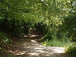
South Street, Bromley
South Street is a hamlet in the far south of the London Borough of Bromley, 16.5 miles (27 km) south south-east from Charing Cross. It is the highest settlement in all of London averaging about 220 metres (722 ft) above sea level. It is about 5 miles (8.0 km) from Junction 5 of the M25. Since the early 1920s, the area has more generally been known as Westerham Hill, the name South Street having fallen out of favour for being overly specific part of Westerham Hill is the highest point in London and as with all of the North Downs its southern face is quite sheer. The south face here is in Kent.Like neighbouring villages, South Street’s principal crop was strawberries, grown on a dozen farms and sold at Covent Garden; grass for grazing (pasture) and haymaking, tending, including shearing of sheep, cows and other animals provided other main agricultural income. South Street also staged an annual horse show and had a stud farm.
Excerpt from the Wikipedia article South Street, Bromley (License: CC BY-SA 3.0, Authors).South Street, Bromley
Main Road, London
Geographical coordinates (GPS) Address Nearby Places Show on map
Geographical coordinates (GPS)
| Latitude | Longitude |
|---|---|
| N 51.297564 ° | E 0.051799 ° |
Address
Main Road
Main Road
TN16 2HW London (London Borough of Bromley)
England, United Kingdom
Open on Google Maps


