Betsom's Hill
Geography of the London Borough of BromleyHighest points of English countiesHills of KentHills of LondonWesterham

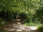
Betsom's Hill is a hill on the North Downs, and the highest point in the county of Kent at 251 metres (823 ft). Situated between Westerham and Tatsfield, at the western edge of the county, it lies close to where the A233 crosses the Downs en route to Biggin Hill. This is the highest part of the North Downs, with Botley Hill the highest point, nearby to the west. The hill lies at the western end of the Kent Downs, an area of outstanding natural beauty.
Excerpt from the Wikipedia article Betsom's Hill (License: CC BY-SA 3.0, Authors, Images).Betsom's Hill
Westerham Hill,
Geographical coordinates (GPS) Address Nearby Places Show on map
Geographical coordinates (GPS)
| Latitude | Longitude |
|---|---|
| N 51.2882 ° | E 0.057188 ° |
Address
Westerham Hill
Westerham Hill
TN16 2EA , Westerham
England, United Kingdom
Open on Google Maps


