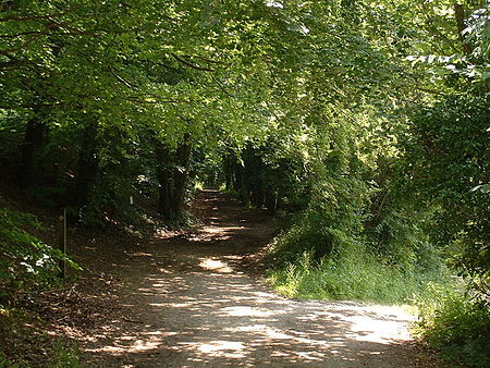
Pilgrims' Way

The Pilgrims' Way (also Pilgrim's Way or Pilgrims Way) is the historical route supposedly taken by pilgrims from Winchester in Hampshire, England, to the shrine of Thomas Becket at Canterbury in Kent. This name, of comparatively recent coinage, is applied to a pre-existing ancient trackway dated by archaeological finds to 600–450 BC, but probably in existence since the Stone Age. The prehistoric route followed the "natural causeway" east to west on the southern slopes of the North Downs.The course was dictated by the natural geography: it took advantage of the contours, avoided the sticky clay of the land below but also the thinner, overlying "clay with flints" of the summits. In places a coexisting ridgeway and terrace way can be identified; the route followed would have varied with the season, but it would not drop below the upper line of cultivation. The trackway ran the entire length of the North Downs, leading to and from Folkestone: the pilgrims would have had to turn away from it, north along the valley of the Great Stour near Chilham, to reach Canterbury.
Excerpt from the Wikipedia article Pilgrims' Way (License: CC BY-SA 3.0, Authors, Images).Pilgrims' Way
Pilgrims Way,
Geographical coordinates (GPS) Address Nearby Places Show on map
Geographical coordinates (GPS)
| Latitude | Longitude |
|---|---|
| N 51.283333333333 ° | E 0.066666666666667 ° |
Address
Pilgrims Way
Pilgrims Way
TN16 2DS , Westerham
England, United Kingdom
Open on Google Maps


