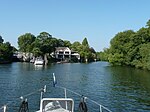
Taplow

Taplow is a village and civil parish in the Unitary Authority of Buckinghamshire, England. It sits on the left bank of the River Thames, facing Maidenhead in the neighbouring county of Berkshire, with Cippenham and Burnham to the east. It is the south-westernmost settlement in Buckinghamshire. The village features a Grade II listed mock-medieval church, the parish church of St Nicholas, as well as a school of the same name. Taplow railway station, on the Great Western Main Line, serves the village, with services to London Paddington, Reading and Oxford. There are two conservation areas in the parish, the Taplow Village Conservation Area and the Taplow Riverside Conservation Area. Footpaths connect all parts of the parish to Maidenhead Bridge and to Burnham Beeches, a modest, hilly wood marking the start of the Chiltern Hills.
Excerpt from the Wikipedia article Taplow (License: CC BY-SA 3.0, Authors, Images).Taplow
Taplow FP9: Old Friend Lane,
Geographical coordinates (GPS) Address Nearby Places Show on map
Geographical coordinates (GPS)
| Latitude | Longitude |
|---|---|
| N 51.531 ° | E -0.687 ° |
Address
Taplow FP9: Old Friend Lane
Taplow FP9: Old Friend Lane
SL6 0EX , Taplow (Beeches Community Board)
England, United Kingdom
Open on Google Maps


