place

MBTA Commuter Rail Maintenance Facility

Buildings and structures in Somerville, MassachusettsMBTA Commuter Rail stations in Middlesex County, MassachusettsPages with no open date in Infobox stationRail yards in Massachusetts
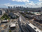
MBTA Commuter Rail Maintenance Facility aerial

The MBTA Commuter Rail Maintenance Facility (signed as, and often known by, its former name of Boston Engine Terminal) is the primary train maintenance repair facility for the MBTA Commuter Rail system. It is located in the Inner Belt area of Somerville, Massachusetts, near North Station in Boston. The present Commuter Rail Maintenance Facility was built in 1995, replacing the Boston Engine Terminal which was built by the former Boston and Maine Railroad. Three small platforms on asphalt crossings serve as flag stops for MBTA employees only. One platform serves the Fitchburg Line, another the Lowell Line, and a third the Haverhill Line and Newburyport/Rockport Line (which split a mile north of the CRMF). It was considered as a possible location for a light rail maintenance facility for the under-construction Green Line Extension. The Green Line facility was ultimately built on an industrial site just west of the Commuter Rail facility.

Excerpt from the Wikipedia article MBTA Commuter Rail Maintenance Facility (License: CC BY-SA 3.0, Authors, Images).

MBTA Commuter Rail Maintenance Facility
I 93, Somerville Charlestown

Geographical coordinates (GPS) Address Nearby Places
placeShow on map

Wikipedia: MBTA Commuter Rail Maintenance FacilityContinue reading on Wikipedia

Geographical coordinates (GPS)

Latitude Longitude
N 42.375 ° E -71.075833333333 °
placeShow on map

Address

MBTA Commuter Rail Maintenance Facility

I 93
02141 Somerville, Charlestown
Massachusetts, United States
mapOpen on Google Maps

MBTA Commuter Rail Maintenance Facility aerial
Share experience

Nearby Places

Lechmere station
Lechmere station

Lechmere station is a Massachusetts Bay Transportation Authority (MBTA) Green Line light rail station in Lechmere Square in East Cambridge, Massachusetts. It is located on the east side of Monsignor O'Brien Highway near First Street, adjacent to the NorthPoint development. The accessible elevated station has a single island platform, with headhouses at both ends. It opened on March 21, 2022, as part of the Green Line Extension (GLX). Lechmere station will initially be served by the Green Line E branch service; D branch service will be added later in 2022. The first transit in East Cambridge was a station on the Boston and Lowell Railroad, which served the neighborhood from the mid-19th century to 1927. Horsecar service through Lechmere Square began around 1861, using the Craigie Bridge to reach Boston, and was electrified in the 1890s. The Lechmere Viaduct was opened in 1912 with an incline to Lechmere Square, allowing streetcars from lines on Cambridge Street and Bridge Street to reach the Tremont Street subway. In 1922, the Boston Elevated Railway opened a prepayment transfer station at Lechmere, separating the surface streetcars from the subway routes. This surface station had a loop for subway cars, with cross-platform transfers to the surface routes, and a small yard inside the loop. The surface streetcars were replaced by trolleybuses and later diesel buses in the 1930s to 1960s, while the subway routes became the Green Line in 1965. Extensions northwest from Lechmere station were first proposed in the 1920s, though planning did not begin until the early 21st century. A new elevated Lechmere station was to be built as part of the NorthPoint development, but it was instead added to GLX planning in 2007. The MBTA agreed in 2012 to open the station by 2017, and a construction contract was awarded in 2013. Cost increases triggered a wholesale reevaluation of the GLX project in 2015. A scaled-down station design was released in 2016, with a design and construction contract issued in 2017. The surface station was closed on May 24, 2020 for Green Line Extension construction; the busways at the old station remained open as a transfer point between MBTA bus routes and Lechmere–North Station shuttle buses until the new station opened.

Lechmere Square
Lechmere Square

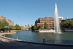
Lechmere Square (pronounced /ˈliːtʃmɪr/ "leech-meer") is located at the intersection of Cambridge Street and First Street in East Cambridge, Massachusetts. It was originally named for the Colonial-era landowner Richard Lechmere, a Loyalist who returned to England at the beginning of the American Revolution. His lands were later seized by the new American government. The shoreline is shown as "Lechmere's Point" on Revolutionary War maps, and was the landing point for British troops en route to the Battles of Lexington and Concord.The area was developed by land speculator Andrew Craigie in the early 19th century. Later, a store was founded in the area and named for it. The Lechmere store expanded into a regional chain, which was closed in 1997 as then-parent company Montgomery Ward filed for Chapter 11 bankruptcy.The area is now best known for the CambridgeSide mall, one of the few full-fledged interior shopping malls within the city limits of Boston and Cambridge, which is on the site of the original Lechmere store (and, when built, incorporated a newly built Lechmere Sales store as one of its anchor tenants). In years past, Lechmere Square was a manufacturing center producing candy, furniture, and caskets. Lechmere Square and the surrounding East Cambridge are currently undergoing a revival of sorts. The area's factories have been or are being converted into office buildings and condominiums. Several large-scale development projects were begun in 2004 and 2005. The results of these projects are yet to be seen. It does appear, however, that East Cambridge and Lechmere Square are undergoing a gentrification process similar to what has been seen in other areas of Cambridge. Lechmere Square is served by Lechmere station of the Massachusetts Bay Transportation Authority (MBTA). The former surface-level station closed in May 2020 for construction of the Green Line Extension; a replacement elevated station opened on March 21, 2022.The Charles River, Lechmere Canal, and Memorial Drive are nearby. Lechmere is also located close to the Museum of Science.

Middlesex County Courthouse (Massachusetts)

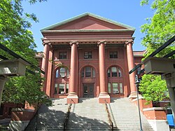
The Middlesex County Courthouse is a historic courthouse building in East Cambridge, Massachusetts. It was initially designed in 1814-1816 by noted architect Charles Bulfinch (1763–1844), and subsequently enlarged in 1848 by Ammi B. Young. The original courthouse was given by Andrew Craigie as part of his scheme to develop East Cambridge. Bulfinch created its plans, and it was erected 1814-1816 on Third Street between Otis and Thorndike Streets. His original stuccoed building is now known by only one surviving sketch, and forms the central core of today's building. In 1848 architect Young enlarged and refaced the building in brick, adding late Federal and Greek Revival details such as a monumental cupola, Palladian windows, and recessed wall arches. A later 1924 addition obscured his 1848 entry facade. In 1973 the buildings were slated for demolition to make a parking lot, but saved by a preservation effort led by architect Graham Gund. Restoration efforts removed the 1924 addition, recreated Young's entry portico, restored its large clock tower, and cleaned and repaired the cupola's gold dome, brickwork, cast-iron trim, wrought-iron fencing, and slate and copper roofs. Other buildings in the restored Bulfinch Square include the imposing Registry of Deeds and Probate Court (1896) with its four giant brick-columned porticoes, the Clerk of Courts Building (1889), and the Third District Court Built (1931, architect Charles Greco). The Middlesex County Courthouse building is situated adjacent to the iconic 16 story former Edward J. Sullivan "Hi-rise" Superior court building.