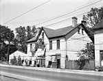
Bedford Park, Toronto

Bedford Park is a neighbourhood just outside the downtown core of Toronto. It borders Lawrence Park (to the southeast) which was ranked Canada's wealthiest neighbourhood in 2011. The City of Toronto's neighbourhood definitions places most of Bedford Park, including Bedford Park Avenue in the Lawrence Park North Planning Neighbourood and the remaining western and northern portions of Bedford Park within a larger neighbourhood, called Bedford Park-Nortown. The border of this larger area extend to Bathurst Street on the west, Highway 401 to the north, Hillhurst Boulevard (just north of Eglinton Avenue) to the south, and zigzags from northeast to southwest along Yonge Street and Avenue Road. There are three census tracts created by Statistics Canada in Bedford Park: 0141.01, 0141.02, 0142.00.
Excerpt from the Wikipedia article Bedford Park, Toronto (License: CC BY-SA 3.0, Authors, Images).Bedford Park, Toronto
Greer Road, Old Toronto
Geographical coordinates (GPS) Address Nearby Places Show on map
Geographical coordinates (GPS)
| Latitude | Longitude |
|---|---|
| N 43.73 ° | E -79.411 ° |
Address
Greer Road 217
M5M 1T2 Old Toronto
Ontario, Canada
Open on Google Maps


