place

Portland General Electric Company Station L Group

1910 establishments in OregonHosford-Abernethy, Portland, OregonNRHPweekly errorsNational Register of Historic Places in Portland, OregonPortland General Electric
OMSI PGE turbine top Portland, Oregon

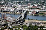
The Portland General Electric Company Station "L" Group in southeast Portland in the U.S. state of Oregon was a cluster of six industrial buildings listed on the National Register of Historic Places. Built between 1910 and 1929 by Portland General Electric (PGE), it was added to the register in 1985. In 1986, PGE gave Station L and 18.5 acres (7.5 ha) of land to the Oregon Museum of Science and Industry (OMSI). The Station L turbine is a central feature of OMSI's Turbine Hall. The complex was listed on the National Register in 1985, and was delisted in 2020.Station L was on the east bank of the Willamette River just south of the Marquam Bridge. The parcel of land on which the six historic one- or two-story structures rested occupied 4.7 acres (1.9 ha) of a larger property owned by PGE. All six were used to house equipment for generating electricity.Five of the listed buildings—the turbine room, the LP boiler room, the Lincoln Substation, the HP boiler room addition, and the 1929 powerhouse extension—were structurally connected. The sixth building, the Stephens Substation, was slightly northeast of the connected buildings. At the time of nomination to the National Register in 1985, the structural condition of the buildings varied from very poor to very good. Major equipment in these buildings in 1985 included an overhead crane, a turbine generator, electric switchgear, furnaces, conveyors, elevated walkways, concrete storage racks, boilers, and pipes. Taken as a whole, the group was the "last relatively complete major wood-fired steam-powered generating station in the Pacific Northwest".

Excerpt from the Wikipedia article Portland General Electric Company Station L Group (License: CC BY-SA 3.0, Authors, Images).

Portland General Electric Company Station L Group
Southeast Water Avenue, Portland Hosford-Abernethy

Geographical coordinates (GPS) Address Phone number Website Nearby Places
placeShow on map

Wikipedia: Portland General Electric Company Station L GroupContinue reading on Wikipedia

Geographical coordinates (GPS)

Latitude Longitude
N 45.508718 ° E -122.666494 °
placeShow on map

Address

Oregon Museum of Science and Industry

Southeast Water Avenue 1945
97214 Portland, Hosford-Abernethy
Oregon, United States
mapOpen on Google Maps

Phone number

call+15037974000

Website
omsi.edu

linkVisit website

OMSI PGE turbine top Portland, Oregon
Share experience

Nearby Places

Marquam Bridge
Marquam Bridge

The Marquam Bridge is a double-deck, steel-truss cantilever bridge that carries Interstate 5 traffic across the Willamette River south of downtown Portland, Oregon. It is the busiest bridge in Oregon, carrying 140,500 vehicles a day as of 2016. The upper deck carries northbound traffic; the lower deck carries southbound traffic. The bridge was designed and built by the Oregon Department of Transportation at a cost of $14 million, equivalent to $117 million today. Construction on the bridge's support piers began in January 1962. The lower southbound deck was opened on October 4, 1966, and the upper northbound deck on October 18, 1966. The main span of the bridge is 440 ft (130 m) long and the two side spans are 301 ft (92 m) each. Vertical clearance of the lower deck is 130 feet (40 m) and the upper deck is 20 feet (6.1 m) above the lower. It is named after Philip Marquam, a state legislator and Multnomah County judge, who owned much of Marquam Hill where Oregon Health & Science University and the Veterans Affairs Medical Center now stand. At the eastern end of the bridge, on the lower deck, is a ramp stub which was intended to connect to the abandoned Mount Hood Freeway. As it has great importance, the Marquam was the first Portland bridge to undergo a seismic retrofit in 1995. The Marquam Bridge was built with economy in mind and the public at large reacted unfavorably to the structure's bland aesthetics, which included a formal protest from the Portland Arts Commission. (In particular, it blocked the view of downtown from the Union Avenue Viaduct.) This led to public input in the design of the Fremont Bridge. During Mayor Vera Katz's State of the City address in 2001, she said, "It’s like having the Berlin Wall dividing east and west, with all the subtle charm of the Daytona 500 smack dab in the middle of our city." The bridge was designed with three lanes in each direction with shoulders on each deck. Today, it carries four narrow lanes and no shoulders on each deck. Options historically considered have been to reroute I-5 over the existing I-405 alignment, connecting I-84 to I-5 at the Fremont Bridge interchange, following the US 30 alignment, and removing the Marquam permanently. Another option would build a tunnel under the Willamette River approximately following the existing I-5 alignment, and remove the Marquam Bridge permanently.Proposals have been made to replace the Eastbank Freeway portion of I-5 with a tunnel, connecting with the existing alignment at the Marquam Bridge and the Rose Quarter. This would free up space along the Willamette River for development.