place

Audrey McCall Beach

2019 establishments in OregonBeaches of OregonHosford-Abernethy, Portland, OregonMultnomah County, Oregon geography stubsUrban beaches
Use mdy dates from January 2020
Portland, Oregon, July 25, 2020 29

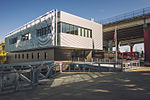
Audrey McCall Beach is an urban beach along the east bank of the Willamette River, near the Hawthorne Bridge in Portland, Oregon, United States. Named after Audrey McCall and spearheaded by the Human Access Project, the beach opened officially on July 5, 2019.Human Access Project removed 19 tons of concrete from the beach during 2013–2019 with assistance of volunteers and inmate work crews.

Excerpt from the Wikipedia article Audrey McCall Beach (License: CC BY-SA 3.0, Authors, Images).

Audrey McCall Beach
South Harbor Drive, Portland Downtown

Geographical coordinates (GPS) Address Nearby Places
placeShow on map

Wikipedia: Audrey McCall BeachContinue reading on Wikipedia

Geographical coordinates (GPS)

Latitude Longitude
N 45.5122911 ° E -122.6680385 °
placeShow on map

Address

Marquam Bridge

South Harbor Drive
97258 Portland, Downtown
Oregon, United States
mapOpen on Google Maps

Portland, Oregon, July 25, 2020 29
Share experience

Nearby Places

Hands Across Hawthorne

Hands Across Hawthorne was a rally held at the Hawthorne Bridge in the American West Coast city of Portland, Oregon, on May 29, 2011. The demonstration was in response to an attack, one week earlier, on Brad Forkner and Christopher Rosevear, a gay male couple who had been holding hands while walking across the bridge. According to the couple and the Portland Police Bureau, a group of five men followed Forkner and Rosevear along the bridge before physically assaulting them. The assault was condemned by Portland's mayor, Sam Adams, and its police chief, Mike Reese, and news of the attack spread throughout the Pacific Northwest and the United States. The attack prompted volunteers from the Q Center, a nonprofit organization that supports the LGBT community, to form street patrols as a means of monitoring Portland's downtown area. Several LGBT and human rights organizations sponsored Hands Across Hawthorne in response to the attack, with the purpose of linking hands across the entire span of the Hawthorne Bridge to show solidarity. More than 4,000 people attended the rally, which had been publicized on a single Facebook page 72 hours previously. Forkner, Rosevear, Mayor Adams, and other community leaders spoke at the rally. The event received attention throughout the United States. On June 5, residents of Spokane, Washington, held a similar hand-holding rally called "Hands Across Monroe", crossing the Monroe Street Bridge in Riverfront Park.

Auto Freight Transport Building of Oregon and Washington

The Auto Freight Transport Building of Oregon and Washington, also known as East Side Terminal and Eastbank Commerce Center, in southeast Portland in the U.S. state of Oregon is a four-story commercial structure listed on the National Register of Historic Places. Built in 1924, it was added to the register in 2005.Occupying an entire block of the Central Eastside Industrial District, the 64,892-square-foot (6,028.7 m2), U-shaped structure has a flat roof, large industrial windows, and a plain interior with concrete floors and walls. The original building, an open warehouse with a few offices on the second floor, has since been divided into spaces for light industry, business, and office work.The original building was part of an industrial complex that developed on the east bank of the Willamette River in the early 20th century. As Portland grew, freight shipments delivered to receiving stations on the river's west side were slowed by heavy traffic on the city's bridges and in the central downtown. Pressure from business owners and civic groups over two decades led to construction of a central eastside receiving station, the Auto Freight Transport Building. The building, served by huge river docks located about 100 feet (30 m) to the west and by rail lines and surface streets, was capable of handling and storing a wide variety of cargo for transhipment to its ultimate destination. In addition, many small freight companies used it for office and lounge space for their employees.The Auto Freight Transportation Association of Oregon and Washington, a group of small trucking companies, operated the terminal jointly until 1938, when the group changed its name to East Side Terminal, Inc., and moved to another building in the Central Eastside Industrial District. Subsequently, the building became a warehouse used by a variety of freight companies.The Auto Freight Transport Building had a small built-in service station. However, around 1930 an adjunct building called the Auto Freight Terminal Service Station, across Southeast Water Avenue, was constructed to provide fuel and mechanical repairs to vehicles using the Transport Building. It continued to function as a service station until the early 1940s.In 1964, relocation of Interstate 5 from the west bank of the Willamette to the east led to removal of the docks and other waterfront structures of the industrial district and demolition of many old industrial buildings. The Auto Freight Transport Building is the best-preserved historic waterfront building in the 680-acre (280 ha) district.

Portland General Electric Company Station
Portland General Electric Company Station "L" Group

The Portland General Electric Company Station "L" Group in southeast Portland in the U.S. state of Oregon was a cluster of six industrial buildings listed on the National Register of Historic Places. Built between 1910 and 1929 by Portland General Electric (PGE), it was added to the register in 1985. In 1986, PGE gave Station L and 18.5 acres (7.5 ha) of land to the Oregon Museum of Science and Industry (OMSI). The Station L turbine is a central feature of OMSI's Turbine Hall. The complex was listed on the National Register in 1985, and was delisted in 2020.Station L was on the east bank of the Willamette River just south of the Marquam Bridge. The parcel of land on which the six historic one- or two-story structures rested occupied 4.7 acres (1.9 ha) of a larger property owned by PGE. All six were used to house equipment for generating electricity.Five of the listed buildings—the turbine room, the LP boiler room, the Lincoln Substation, the HP boiler room addition, and the 1929 powerhouse extension—were structurally connected. The sixth building, the Stephens Substation, was slightly northeast of the connected buildings. At the time of nomination to the National Register in 1985, the structural condition of the buildings varied from very poor to very good. Major equipment in these buildings in 1985 included an overhead crane, a turbine generator, electric switchgear, furnaces, conveyors, elevated walkways, concrete storage racks, boilers, and pipes. Taken as a whole, the group was the "last relatively complete major wood-fired steam-powered generating station in the Pacific Northwest".