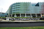
Flemington Road
Australia road stubsMelbourne geography stubsStreets in MelbourneTransport in the City of Melbourne (LGA)Use Australian English from March 2018
Flemington Road is a major thoroughfare in the inner suburbs of North Melbourne and Parkville in Melbourne, Victoria, Australia. It runs for 2 km in a northwest–southeast direction, from the southern end of Mount Alexander Road, Flemington, to Haymarket roundabout and the northern end of Elizabeth Street, and provides a main connection between the northern arm of the CityLink tollway and Melbourne's CBD.
Excerpt from the Wikipedia article Flemington Road (License: CC BY-SA 3.0, Authors).Flemington Road
Flemington Road, Melbourne North Melbourne
Geographical coordinates (GPS) Address Nearby Places Show on map
Geographical coordinates (GPS)
| Latitude | Longitude |
|---|---|
| N -37.794444444444 ° | E 144.94833333333 ° |
Address
Stop 19: Royal Children's Hospital
Flemington Road
3051 Melbourne, North Melbourne
Victoria, Australia
Open on Google Maps


