Ashley, Northamptonshire
Civil parishes in NorthamptonshireNorth NorthamptonshireNorthamptonshire geography stubsOpenDomesdayRoman villas in Northamptonshire ... and 2 more
Use British English from March 2014Villages in Northamptonshire

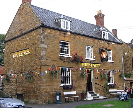
Ashley is a village and civil parish in the North Northamptonshire, England, about 4 miles (6.4 km) northeast of Market Harborough, Leicestershire and 5 miles (8.0 km) west of Corby. The population of the civil parish at the 2011 census was 224. The village is near the River Welland, which forms the border with Leicestershire. The Roman road called Via Devana in the part from Ratae (now Leicester) to Duroliponte (now Cambridge) ran just north of the village. The village's name means 'ash-tree wood/clearing'.
Excerpt from the Wikipedia article Ashley, Northamptonshire (License: CC BY-SA 3.0, Authors, Images).Ashley, Northamptonshire
Ashley Road,
Geographical coordinates (GPS) Address Nearby Places Show on map
Geographical coordinates (GPS)
| Latitude | Longitude |
|---|---|
| N 52.5 ° | E -0.83 ° |
Address
Ashley Road
Ashley Road
LE16 8PL , Stoke Albany
England, United Kingdom
Open on Google Maps


