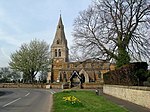
Stoke Albany
Civil parishes in NorthamptonshireNorth NorthamptonshireNorthamptonshire geography stubsUse British English from March 2014Villages in Northamptonshire

Stoke Albany is a village and civil parish in North Northamptonshire, England. It is off the A427 road between Market Harborough and Corby, about halfway between the two. At the 2011 Census, the population of the parish (including Brampton Ash and Little Bowden) was 390, an increase from 330 at the 2001 Census.The village's name means 'outlying homestead/settlement'. The village was held by William de Albinni in 1155. The western piece of Corby hundred shaped a different hundred named 'Stoke'.St Botolph's Church is a Grade II* listed building.
Excerpt from the Wikipedia article Stoke Albany (License: CC BY-SA 3.0, Authors, Images).Stoke Albany
A427,
Geographical coordinates (GPS) Address Nearby Places Show on map
Geographical coordinates (GPS)
| Latitude | Longitude |
|---|---|
| N 52.4795 ° | E -0.8161 ° |
Address
A427
LE16 8RE , Stoke Albany
England, United Kingdom
Open on Google Maps


