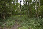
Sandon, Hertfordshire

Sandon is a village and civil parish in the North Hertfordshire district, in the county of Hertfordshire, England. Sandon is located near the towns of Baldock and Buntingford. The parish also includes the hamlets of Green End and Roe Green, and Blagrove Common, a nature reserve. At the 2011 Census the population of the civil parish was 495.Sandon has 47 listed buildings, including one of Britain's estimated 200 medieval barns, the construction of which has been dendrochronologically dated to 1266–68. All Saints Church.The Icknield Way Path passes through the village on its 110-mile (180 km) journey from Ivinghoe Beacon in Buckinghamshire to Knettishall Heath in Suffolk.
Excerpt from the Wikipedia article Sandon, Hertfordshire (License: CC BY-SA 3.0, Authors, Images).Sandon, Hertfordshire
Payne End, North Hertfordshire
Geographical coordinates (GPS) Address Nearby Places Show on map
Geographical coordinates (GPS)
| Latitude | Longitude |
|---|---|
| N 51.99269 ° | E -0.0766 ° |
Address
Payne End
Payne End
SG9 0QU North Hertfordshire
England, United Kingdom
Open on Google Maps


