Therfield
Civil parishes in HertfordshireVillages in HertfordshireWikipedia indefinitely move-protected pages

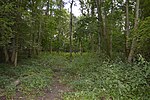
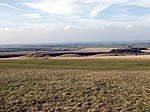
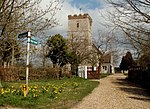
Therfield is both a small village of approximately 4,761 acres (19 km²) and a civil parish which sits upon the chalk range, three miles southwest of Royston, and six miles (10 km) northeast of Baldock and within the English county of Hertfordshire.
Excerpt from the Wikipedia article Therfield (License: CC BY-SA 3.0, Authors, Images).Therfield
Church Lane, North Hertfordshire
Geographical coordinates (GPS) Address Nearby Places Show on map
Geographical coordinates (GPS)
| Latitude | Longitude |
|---|---|
| N 52.0163 ° | E -0.0575 ° |
Address
Church Lane
SG8 9QD North Hertfordshire
England, United Kingdom
Open on Google Maps


