place

Fil de Cassons

FlimsMountains of GraubündenMountains of SwitzerlandMountains of the AlpsTourist attractions in Graubünden
Tourist attractions in SwitzerlandTwo-thousanders of Switzerland
Fil de Cassons
Fil de Cassons

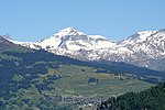
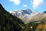
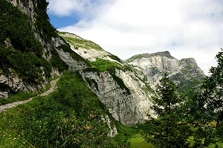
Fil de Cassons (also known as Cassonsgrat) is a mountain in the Glarus Alps, located near Flims in the canton of Graubünden, Switzerland. The southern face is referred to as "Flimserstein", dominating the appearance of the town of Flims. In its east lies Bargis from where a valley leads to its north face, while to its western face the sliding surface tears off of the biggest visible landslide in the world, Flims Rockslide. Piz Dolf is lying to the north across the Bargis valley, and to its west Piz Segnas, both showing the tectonic line of the Glarus thrust in its upper part, a now UNESCO world heritage. The easiest access to Fil de Cassons is an aerial cableway from Flims to this ridge, that actually allows also walks and an alpine experience from the cablecar for people that would not dare to walk a steep mountain path. Walking on top you will easily identify the tectonic line under your feet, as rocks turn from greenish to bright light grey on top of the wide ridge. For hikers aiming for more than a walk, several routes reach the high plateau and the very wide ridge, among them a historic Via Ferrata called Pinut. One hiking route uses the ascent via Val Bargis and Scala Mola, the path that the cows are being sent up to graze in summer. If you stay at the base of the valley of Bargis, you will hike on a path leading more or less around Fil de Cassons from east to northwest before reaching its top.Being a ridge, there is very often hardly snow, allowing walks even in winter along at least one mile on Fil de Cassons.

Excerpt from the Wikipedia article Fil de Cassons (License: CC BY-SA 3.0, Authors, Images).

Fil de Cassons
Alpiner Lehrpfad,

Geographical coordinates (GPS) Address Nearby Places
placeShow on map

Wikipedia: Fil de CassonsContinue reading on Wikipedia

Geographical coordinates (GPS)

Latitude Longitude
N 46.878472222222 ° E 9.2801388888889 °
placeShow on map

Address

Geologische Beschreibung

Alpiner Lehrpfad
7017
Grisons, Switzerland
mapOpen on Google Maps

Fil de Cassons
Fil de Cassons
Share experience

Nearby Places

Crestasee
Crestasee

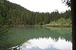
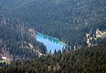
Crestasee (Romansh: Lag la Cresta) is a small lake shared by the municipalities of Flims and Trin in the Grisons, Switzerland. From 1892 a guest house on its northern end served as pension and still is a restaurant today in its original state. There is no tributary to the lake. The rough character of the whole area derives from being a debris area of the gigantic Flims Rockslide, where waters flow underground until feeding lakes at certain spots such as Crestasee, Caumasee or Lag Prau Pulté. Less than 100 yards (91 m) from its northern end a gorge called "Felsbachschlucht" is formed by river Flem, coming from Flims, whose Romansh name is also Flem. The waters from the lake and river are independent, and of course the river had only some 10 000 years to create the gorge as this is the age of the rockslide. The water from the lake forms a small stream and enters the Flem river after a very short run, not called a special name for its short length. In summer it is well known for swimming and offers facilities (such as a kiosk, toilets, changing room, boats and SUP's to rent) to enjoy this. An entrance charge will be collected by an employee of the restaurant, walking around the lake once or twice a day. Crestasee can be reached from Flims via the Felsbachschlucht gorge or wide forest paths, as well as from Trin Mulin or the public post car stop Felsbach/Crestasee on the main road, to where it is connected by a nice and short path. Motorists have to walk a similar distance to the lake, as there is no access to the lake by car and signposted parking is well off the lake. A forest walk leads to Conn, to see the Ruinaulta gorge formed by the Rhine, still within the same huge rockslide debris area, or to the Lag la Cauma.