Tristelhorn
Alpine three-thousandersCanton of St. Gallen geography stubsFlimsGlarus thrustGraubünden mountain stubs ... and 6 more
Graubünden–St. Gallen borderMountains of GraubündenMountains of SwitzerlandMountains of the AlpsMountains of the canton of St. GallenStructural geology stubs

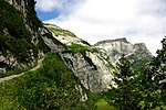
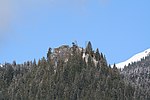
The Tristelhorn (also known as Piz da Sterls) is a mountain of the Glarus Alps, located on the border between the Swiss cantons of St. Gallen and Graubünden. Reaching a height of 3,114 metres above sea level, it is one of the highest summits in the canton of St. Gallen. The Tristelhorn is located west of the Ringelspitz, on the range separating the Calfeisen valley (St. Gallen) from the Rhine valley near Flims (Graubünden).
Excerpt from the Wikipedia article Tristelhorn (License: CC BY-SA 3.0, Authors, Images).Tristelhorn
Geographical coordinates (GPS) Address Nearby Places Show on map
Geographical coordinates (GPS)
| Latitude | Longitude |
|---|---|
| N 46.901666666667 ° | E 9.3166666666667 ° |
Address
Culm da Sterls
7019
Grisons, Switzerland
Open on Google Maps


