Widdington
Civil parishes in EssexEssex geography stubsUttlesfordVillages in Essex

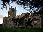
Widdington is a village and civil parish near Saffron Walden, in the Uttlesford district, in the county of Essex, England. The population of the parish at the 2011 census was 504. The village is located near the M11 motorway. Widdington has a church dedicated to St Mary the Virgin. Prior's Hall, now a private residence, is a rare survival of a stone-built structure from the late tenth or early eleventh centuries; Prior's Hall barn, from the fourteenth-century, is nearby.Widdington was recorded in the Domesday Book of 1086 as Widituna. The entry reads: Widi(n)tuna: St Valery Abbey; Robert from Robert Gernon; Ranulf Peverel.
Excerpt from the Wikipedia article Widdington (License: CC BY-SA 3.0, Authors, Images).Widdington
High Street, Uttlesford Widdington
Geographical coordinates (GPS) Address Nearby Places Show on map
Geographical coordinates (GPS)
| Latitude | Longitude |
|---|---|
| N 51.961111111111 ° | E 0.2375 ° |
Address
High Street
CB11 3SG Uttlesford, Widdington
England, United Kingdom
Open on Google Maps


