place

East Andover, New Hampshire

Andover, New HampshireNew Hampshire geography stubsUnincorporated communities in Merrimack County, New HampshireUnincorporated communities in New HampshireUse mdy dates from July 2023
East Andover Church
East Andover Church

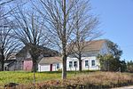
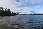
East Andover is an unincorporated community in the town of Andover in Merrimack County, New Hampshire, United States. The center of the community forms the East Andover Village Center Historic District. The village is located on the east shore of Highland Lake, along New Hampshire Route 11 in the eastern portion of Andover. Route 11 runs east to Franklin and New Hampshire's Lakes Region, and runs west to the rest of Andover and the Lake Sunapee region. The village was a station along the former Northern Railroad connecting Concord to the southeast with White River Junction, Vermont to the northwest. The railroad grade is now the route of the Northern Rail Trail, currently extending from Penacook in the east to Lebanon in the west. East Andover has a separate ZIP code (03231) from the rest of the town of Andover.

Excerpt from the Wikipedia article East Andover, New Hampshire (License: CC BY-SA 3.0, Authors, Images).

East Andover, New Hampshire
Northern Rail Trail,

Geographical coordinates (GPS) Address Nearby Places
placeShow on map

Wikipedia: East Andover, New HampshireContinue reading on Wikipedia

Geographical coordinates (GPS)

Latitude Longitude
N 43.459166666667 ° E -71.748055555556 °
placeShow on map

Address

Northern Rail Trail

Northern Rail Trail
03231
New Hampshire, United States
mapOpen on Google Maps

East Andover Church
East Andover Church
Share experience

Nearby Places

East Andover Village Center Historic District

The East Andover Village Center Historic District encompasses the historic village center of East Andover, New Hampshire, United States. The 2.2-acre (0.89 ha) district includes a cemetery and three buildings: the Andover Congregational Church, the Highland Lake Grange Hall, and the East Andover Schoolhouse. It is located at the corner of New Hampshire Route 11 and Chase Hill Road. The district is unified by the appearance of the three buildings (all are sheathed in clapboards and painted white), and their styling, which is predominantly vernacular 19th century. The Andover Congregational Church is the oldest of the three buildings, built in 1796 to provide space for civic and religious functions in the town. It is a two-story wood-frame building, with a pair of entrances on the main facade, which provide access to a vestibule area, from which access to the main hall is gained, with stairs leading up to galleries on either side. The building was used by the town for meetings and by several religious organizations for services, but had by 1822 fallen into some disrepair. It was extensively rebuilt in 1840, including turning the building so that its main facade faced south. This work including the addition of the tower and the Greek Revival styling the building now shows. It has received only minor modifications since then.The Old North Church Cemetery was deeded to the town in 1805, although it seems to have been used before then, since at least two burials predate this transfer. Burial plots are laid out in north–south rows in the half-acre cemetery, which was filled up by the late 19th century. The cemetery stretches out along Route 11, behind (north of) the church. The Highland Lake Grange Hall was built in 1850 by the Mountain Club, an East Andover literary club that sought a meeting place for itself, and wanted to promote secondary education in the town. The building was inaugurated that year as the Highland Lake Institute, an academy that lasted just five years. It then saw a succession of academic and civic uses, and was enlarged in 1893 and renamed Union Hall. In 1938 the Union Hall Associates sold the building to the local grange chapter, which had been meeting on the premises since 1894. Little modification has been made to the building since 1893.The East Andover Schoolhouse was built in 1903 to replace the old District 10 schoolhouse, which had been located just south of the grange hall. Located just east of the grange hall, the building served as a public school until 1962; its most significant alteration in this period was the addition of a wood and coal shed to the rear. The building was sold to the church, which has since used it for Sunday School and as a nursery.The district was listed on the National Register of Historic Places in 1989.

Hopkins Pond (New Hampshire)

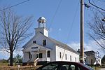
Hopkins Pond (also known as Adder Pond) is a small pond located at the south foot of Ragged Mountain, in the town of Andover, New Hampshire, United States. It lies at an elevation of 644 feet (196 m). The pond is part of Proctor Academy's 2,500-acre (10 km2) campus in Andover and is jointly managed by Proctor and the New Hampshire Fish and Game Department. The pond area is open to the public for non-motorized boat travel, fishing and hiking. This shallow pond has an average depth of 6 feet (1.8 m), is 15 feet (4.6 m) deep at the deepest point, and covers a total area of 27 acres (11 ha). It empties eastward into Mountain Brook below Elbow Pond. Mountain Brook, in turn, is a tributary of the Blackwater River, which flows via the Contoocook River and Merrimack River to the Gulf of Maine (Atlantic Ocean) at Newburyport, Massachusetts. Hopkins Pond sits within the Merrimack River watershed, and is floristically considered part of the Sunapee Uplands sub-region of the Lower New England-Northern Piedmont Ecoregion, as defined by The Nature Conservancy, and the New England-Acadian Forest Ecoregion, as defined by the World Wildlife Fund.The north shore of Hopkins Pond can be accessed from the west by Middle Hopkins Pond Trail. The south shore can be accessed from Lower Hopkins Pond Trail. Both shores can be accessed from the east by an NH Fish and Game access road off Elbow Pond Road. Observed species of fish in the pond include rainbow trout and brook trout.